Tues 28th Adult Basic Skills Course Commences. Pool 7.30pm
February
Mon 3rd Club Meeting: Stoves and Food. A look and discussion of alternative stove designs and pots. How much better is titanium? Then a discussion and tasting of expedition food/menus from 5 experienced kayakers/chefs. Scout Hall 8pm
Thur 9th (TBC) Day Paddle (Sea). Date and location dependent upon weather.
Sat 15thRiver Trip. These trips will involve both canoes and kayaks and are aimed at taking those with Basic and Pool skills up to 3 Star level
Thur 23rdSea Kayak Training Part 2. This part covers passage planning, navigation and safety systems. Scout Cottage 8pm
March
W/E 1st/2nd Sea Kayak Trip. Depart Helensburgh for Mark Cottage Bothy on Loch Long via KIlcreggan and Ardentinny. This is a training paddle/weekend and suitable for those who are completing the sea kayak expedition course.
Mon 3rdAGM and Photo Competition . Competition topics: i) Weather ii) People and Paddles. Illustrated report on year from chair and discussion of the BCU/UKCC award system from Chief Coach. Scout Hall 8pm
Sat 22ndRiver Trip
April
Mon 7th Club Meeting: “Sleeping Systems” A look at and discussion of all things sleeping; tents, bags and mats. Is a geodesic worth the money and weight? How much larger and comfier is a down mat? Is a down bag that much better?
Tues 8th Basic Skills Course finishes
Sat 19thRiver Trip
W/E 27th/28th2 Star Assessment. £20 for 2 days of instruction and assessment
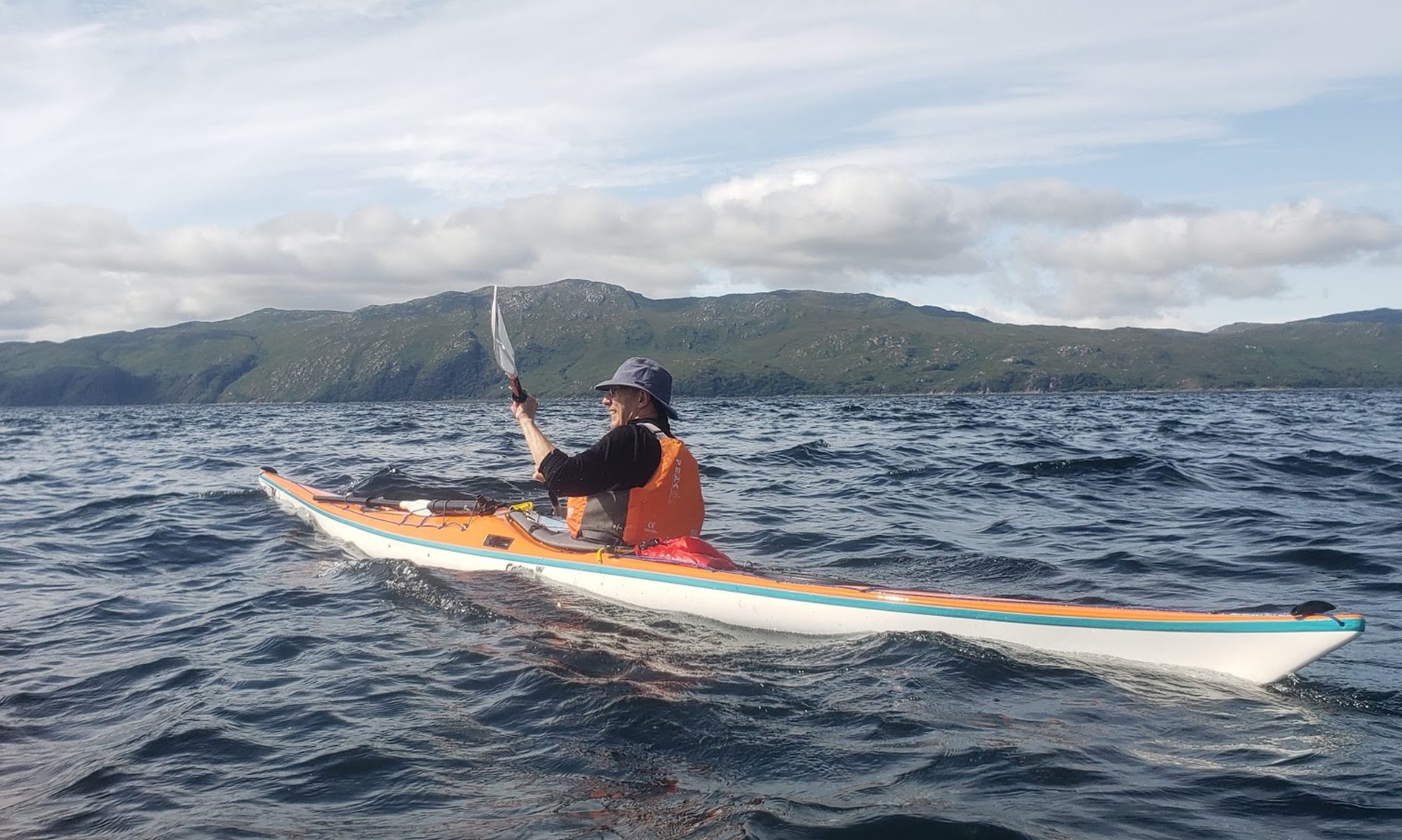
We didn’t have to travel far to get some rough water as the wind was blowing from the south west at about F3-F4 around the East Patch, so we headed out from Helensburgh pier a couple of hours before HW. The idea was to mess about in the waves and clapotis coming off the sea walls, however it didn’t amount to much as we decided to head for Rosneath Patch and see what it was like over there.
It took about and hour to get there, directly into the prevailing wind and incoming tide. The wind seemed to be coming from a few directions during the trip,which resulted in waves coming from all sides. This may account for the smallish waves for the wind conditions. It did appear that the tide had turned early just off Rosneath point and at the Patch IDM mark, where there were 1ft breaking standing waves. The light was fading fast as we headed back, getting lots of small waves to speed us along, with the odd section burying the nose of our boats and providing long surfs. The best section was just off Rosneath point where the waves were breaking and maybe reached 2ft. But we didn’t have time to stay as it was dark by then and we had a shipping lane to get through.
All in all it was good fun and we got back to the pier at 1630 after a good couple of hours paddle. We didn’t do any rescue practice due to the light, but I did have a roll in during a rough section and was reminded of the difference between rolling in the pool and on open water with full kit on – basically due to the air in my dry suit and flotation in my buoyancy aid it was very tricky to do a full roll. I ended up having to roll on my left side instead of right as I could not get all the way round.
One strange thing that happened during the trip was that Fraser heard talk on the VHF ch12 (Estuary control) referring to two sea kayaks. He could not hear the full conversation due to the wind. The worry was that a concerned member of the public had see our cars with kayak racks and thought we were in trouble as it was dark and a bit windy. Just to make sure we hadn’t caused an international incident we contacted Estuary control when ashore, but they said it was not them. We also called Belfast Coast Guard who also said they had not heard anything, so a bit of a mystery. In future I will make sure that I contact the CG prior to going out if it’s likely I’ll be out after dark.
Ann, Jamie and Euan waiting at the start at Banavie
Paddlers: Euan, Grant, Jamie S, Geoff, Anne and Jamie
Weather: Very Cold. Very Wet and Windy
Report: The route follows the Caledonian Canal and full details can be obtained at Great Glen Canoe Trail.
We started at the top loch at Banavie (Fort William), where low pontoons have been constructed for easy entry and exit from canoes. Exit from the sea kayaks is more problematic; akin to exit at the Pool.
The weather was quite pleasant, cold but with occasional sun. The canal itself is excellent paddling, wide and attractive with stunning view over to Ben Nevis and the Grey Corries.
The background of Ben Nevis and the Grey CorriesPaddling the Great Glen
Whilst we had expected the cold, it was the very short days, often gloomy, that had the most effect. We really needed to have sorted out a campsite by 3.30 and, after the shuttle run with the cars, rarely left before 10am in the morning. The curtailed day meant that the full trip to Inverness was simply not feasible in canoes.
Our first camp site was the informal one at the far end of the long portage at Gairlochy Lochs. The toilet block (with piping hot water!) was close by. We paid £5 each for a key to these facilities for the period of our trip. In addition there was a good wood supply and although the temperature was dropping rapidly a good evening was had until the rain set in at 8.30.
Around the Camp Fire
It rained incessantly and squalls hit the tents despite our sheltered position. Meanwhile the temperature dropped to zero. Not the best of nights for some of the party.
Breakfast
With a degree of unwillingness to leave sleeping bags we did not get away until around 10am. The wind, which had been SW had swung northward and strengthened to force 5 with squalls of force 7. Meanwhile the continuous rain was complemented by periodic downpours.
Heading up Loch Lochy
The canoeists, meanwhile were trying to erect a sail on a catamaran formed from the two boats.
Erecting a Sail
Unfortunately the squalls were too strong and the canoeists simply skudded up the Loch in the wind until South Laggan Locks were reached.
Unlike Gairlochy, South Laggan provides little real shelter from the wind and little wood. The informal camp site is some way from the toilet block and its life saving radiator and hot water. A long not very pleasant night could be forecast. A decision was made to find a pub for the evening and three of the group defected to a hostel in Fort Augustus. The others camped on the canal bank by the toilet block in one of the few sheltered areas.
Camping at South Laggan
After another cold night the following day was much improved. Still grey and cold the wind had swung back to the south west and was much lighter. The route led up the canal for a couple of kilometers, under the swing bridge at North Laggan and out onto Loch Oich. The canoeists eventually managed to rig a sail and for the first time managed to keep up with the kayakers.
Sailing
At the end of the loch the routes diverged. The kayakers, anxious to avoid any damage to their composite boats opted for the canal, whilst the canoeists took the plunge down the River Oich. Although progress on the canal was good the two portages meant the kayakers reached Fort Augustus almost an hour later than the canoeists.
There is no loch-side camping at Fort Augustus and no road access to the informal site a few miles up on the east side of the loch (necessary for the car shuttle). We thus all made the decision to use hostel accommodation for the night. A shower, food and pub followed.
Sunday had the best weather of the trip with a lot of sun providing some heat and just the lightest of south westerly breezes. An extensive debate ensued between those wanting to push on to Drumnadrochit and those who simply thought we could not make it in the light. Foyars was possible but the car shuttle time ruled it out. In the end we decided to leave the cars at Invermoriston, paddle on past towards Foyars and then return back to Invermoriston.
We made excellent progress in the bright sun and pulled up for lunch some 3km north of Invermoriston.
Paddling up Loch NessLooking North up Loch Ness
After a prolonged lunch the cold started to creep in again and we decided to make tracks back to Invermoriston.
The return
The car was parked in the village and we attempted to paddle up the river to get as close as possible. Sadly after the hydro barrage the river is impassable so we set off south to find a place close to the road where we could load. We eventually found a place about 1 mile south of the village. After Collection of cars from both Invermoriston and Fort Augustus and packing cars and trailer we were off homebound around 3.30.
Some Thoughts:
This is a lovely, if unexciting paddle. The cold and darkness were the real challenge. We had the wind behind us every day; to go against it would be a nightmare. Whilst facilities are good, parking and camping is limited. In winter you can get away with camping on the canal edge. You need to get away early each morning which means setting up the car shuttle the night before if at all possible. You do not want to get out of the tent when it is both very cold and dark. Canoes are sociable and carry big loads but are at least 25% slower than sea-kayaks.
In conclusion this was a very successful trip that could have been improved. If you are thinking of doing it in midwinter, plan very carefully with someone who has done it before and can give advice.
Weather: Very cold but beautiful clear blue skies. Light breeze that occasionally strengthened.
Report: The ice was still on the boats as we launched and paddled south towards the mouth of Loch Goil. There was a light covering of snow on the hills that did not melt, although in the sun it was quite warm. Out of the sun or in the breeze, however it was extremely cold. A Force 4/5 from the north was forecast later in the day and, being late November, we were expecting darkness at around 4pm, so our plan was to turn back at around12.30.
The entrance to Loch Goil
We paddled lazily most of the way down the Loch until we found a lovely lunch stop in the sun.
Paddling up Loch Goil
As the afternoon progressed the cloud cover became wider, the breeze slightly stronger and the cold more obvious.
Paddling Back
The paddle back with the breeze was much faster than expected and as we were crossing Loch Long we suddenly decided to make an inspection visit to the MBA bothy at Mark. We were welcomed by two bothiers and a lovely fire. The bothy was in excellent condition.
We left the bothy just after 2.30 for the 10 minute paddle across to Finnart and the cars. An excellent day.
Sun 17th: Sea Kayak Display, Largs Marina. 10am on. Loads of Kayaks and kayak gear from Sea Kayak Oban. Take your kayaking gear and try out your dream boat.
Tuesday 19th: Day Paddle, Loch Long and Loch Goil. Meet Finnart at 9.30am. Back by 4pm.
Thursday 21st: Talk: The Argyll Kayak Trail. Scout Hall, John St. 7.30. A chance to discuss with the project manager Russell Daniels what is being done, the objectives and the potential dangers of the route from Helensburgh to Oban. Everybody welcome; please make an effort to attend and bring friends and any others interested.
Wednesday 27th to Saturday 30th: Great Glenby Kayak or CanoeA mid-winter challenge. Please let me know if interested.
December
Thursday 5th: Seasonal Dinner. Commodore from 6.30. Come for the dinner or just a drink from about 8.30.
Friday 6th: Glasgow’s Xmas lights from the Clyde. Meet slip at Maritime Museum at 8pm for a paddle up river. A unique experience.
Paddlers: Morag, Ian, Mark T, Lee, David H, Mark C, David N, Mel, Geoff, Douglas, Michael, Oliver, Keith, Ross
Weather: Sunny with very blustery showers.
Report: After a terrible week of weather, Sunday promised relief if a bit windy for the Basic Skills paddle. On the Sunday morning the wind appeared to be Force 4 from the NW, not really normally suitable for beginners. The shelter at Aldlochlay suggested, however, that we should be able to do something if only creep along the shore. As it turned out the hills and islands sheltered us almost completely with only one or two points exposed to the wind. The crossings to/from Inchvannach were, for example, very quiet whilst the exit north from the narrows was anything but.
The route started south past the “little boy” statue. The autumn colours were glorious.
With relative calm we crossed to Inchvannach and then on to Inchmoan.
The beach to the north was flooded so we headed back to the main beach for a break. Then on up north through the narrows to a beach at the top of Inchvannach.
After a lunch break we set off again just as the strongest of the blustery showers hit us. It was so fierce we simply sat off the beach until it eased and then pushed on into the waves and wind. All made it to the next beach, some having far less trouble than others, the canoeists suffering most in the high wind. As the cloud cleared we were treated to a glorious rainbow
A second calm crossing and we were back by 2pm. Another excellent day on Loch Lomond.
1. The Basic Skills course finishes in the Pool on Tuesday November 5th.
2. The third outdoor session of the course will be a paddle round the Islands of Loch Lomond on Sunday 3rd November, meeting at the lay-by at Aldlochlay at 10am. We should finish about 2pm so bring something to eat and drink. Everybody in the club is welcome. Please could you confirm you are coming and the equipment you need.
3. A reminder that The Paddle Show is on in Perth on 25th/26th October. It is thoroughly recommended.
4. The Sea Expedition course starts on Tuesday Nov 12th at the Pool. It is in two parts. The first 5 weeks (until Xmas) primarily concerns Safety and Rescue at sea. Initially we concentrate on group rescues and then progress to self rescue with floats and rolling. There will be a sea paddle in November or early December and the cost for this section is £20. The second half of the course looks at Planning and Navigation (and how to ensure you do not need those safety techniques) and will take place on Thursday evenings in the New Year. One session will also look in detail at what to take in the way of camping and clothing equipment. Participants are also invited to continue to develop their rescue and rolling skills in the Pool on Tuesday nights along with other club members.
5. There will be a talk on Thursday 21st November at 7.30 in the Scout Hall, John St on the Argyll Kayak Trail by Russell Davies the Project Officer. The trail runs to Oban via Helensburgh, Kyles of Bute and the Crinan Canal and involves various projects, such as pontoons and trolleys on the Crinan Canal, to make life a bit easier. Everybody is welcome.
Location: This was the fourth trip to SW Turkey based in the general Dalaman Area. As might be expected this was the furthest from the airport and the base of our provider in Fethiye.
Location of current and previous trips
To cover the best marine scenery the trip was in two, three day sections with a vehicle transfer between. It could be done as a single trip with a 25nm slog along an uninteresting coastline but the loss of the first day due to wind, ruled that out.
Part A: Kas to Sulkulu Beach, near Demre.
We arrived in Turkey just before 10pm and were transported, with kayaks and equipment to the holiday resort of Kas and our overnight Pension. The accommodation was chosen because it apparently had direct access to the sea from their “Beach”. In fact the beach constituted of small concrete sunbathing platforms with a set of steps for entry/exiting the sea. There was no alternative; kayaks are not allowed to use the slip in the little harbour in the centre of town even if we could have got the kayaks there.
A large storm had hit the area over the previous three days generating a large swell. In addition the wind forecast for the first day threatened Force 7 winds . Kayaking was obviously impossible so we spent the day wandering in the town and doing touristy things like visiting a water cistern dated around 600BC and the Roman Ampitheatre seating 12,000.
KasWater Cistern (Storage) dated 600BC
After a pleasant if frustrating day, the Friday opened slightly overcast but with much lighter winds. We loaded the kayaks and manipulated them down the platforms to the water edge. By strategically locating one paddler (Geoff) in the sea we managed to lower the boat into the swell whereupon it landed on a jaggedy rock. When kicked off the rock it decided that upside down was more stable. It was righted half full of water and the paddler (Geoff) got in and started pumping, whereupon the pump came apart. Apparently two hands were required for the pump leaving none for the paddle or simply hanging on. The second kayak was lowered for support and using this it was just possible to pump enough out to stop the first kayak from sinking. The third kayak was lowered and the other two paddlers got in. After more frantic paddling spray decks were fitted and we were away. Clear of the shore there was further pumping and then we were truly away on the following route.
Route for the first three days
The coastal scenery in this part of Turkey is superb. Broken limestone cliffs are peppered with deep sea caves and the water is a perfectly clear turquoise blue. The sun was shining and the brisk breeze and 4ft swell added interest.
The Greek Island of Meis is in the backgroundThrough a wet lens on a choppy sea
Cave Exploration
Landing places were very rare. The lunch break was typical of unfinished tourist based schemes that litter the coastline.
Lunch Stop
Our destination for the evening was the ancient city of Apelie. A typically amazing ruin, the city was founded in the Lycian era (c 600BC) and became very rich on the basis of a shellfish that provide the dye for the imperial purple of the Roman Emperors. The area includes huge city walls, mausoleums and a sunken harbour; uninvestigated and likely to remain so.
ApelieInside the City
We camped, without charge, in the campsite known as The Purple House. This also provided beer (which we utilised), meals and accommodation. We were surprised to find fairly large numbers walking the Lycian Way long distance footpath, which passes through Apelie.
Campsite 1
Our target for Day 2 was the region known as Kekova. This has become something of a tourist magnet with ancient ruins, a sunken city and a Byzantine Castle a pleasant boat trip from the east. Before we could experience the calm waters behind the isalnd we had to endure a stiff paddle into a force 3/4 wind and a rising swell. We eventually reached a small island with a rough landing, the first of the day. Typically it had a number of ancient ruins scattered over the hillside.
Lunch with ruins
The main selling point of Kekova is the “submerged city” and amongst the hundreds of motor vessels a number of commercial firms offer kayak trips to beginners that go over the site. Our experience was disappointing. Although the water was clear it was disturbed by the wind and reflected the strong sunlight. As a result we saw little and had to queue (!!) with the motor boats.
Far more impressive was the Byzantine fort in the village opposite.
Kale Castle
Our access involved pushing through deep undergrowth, climbing the wall of an outlying tower, walking through a garden marked “Strictly Private” and “Dangerous Dog” and scaling a wall to get out, The fort itself was an amazing tribute to the absence of Health and Safety Inspectors in Turkey.
The village of Simena (Kale) is a landlocked maze, with tiny alleys connecting a motley connection of buildings. It is a wonderful place but time was pressing.
From Simena we paddled on east looking for potential landing/camping sites. Eventually we found a small beach with an ornate gate leading to a ruined farm. This provided level, if stony pitches and wood for a fire.
Entrance to SiteCamp Site 2View from Site
Typically just above the farm was a ruined castle.
Castle above site
Our progress had been good and Day 3 was asssumed to be a more gentle affair. As ever there were a selection of caves to visit and some wonderful cliff scenery.
Inside a large Cave
We paddled on to Andriake Beach for lunch where Hugh successfully pursued his desire for a fish sandwich and we had a couple of beers. Andriake is an important historic port with ancient temples and a huge intact grain warehouse built by Herod. It is also the port for Myre, the home town of Father Xmas (aka St Nicholas). We really ought to go back at some time to see it.
Typically during our prolonged lunch break the wind changed direction and grew in strength and the final leg from Andriake to Sukluku was something of a challenge. However we were there is good time for our 4pm transfer.
The End of Part A
Part B: Makivent to Cisali
After a tortuous journey through urban/rural sprawl we arrived at a stony beach near Mavikent fringed by a couple of miles of shacks. Because it was growing dark we had little option but to camp in the rather dirty surroundings using rocks to secure the tents. However there was enough wood on the beach to have a good fire.
The morning was lovely. Beach camping offers fantastic views.
View from inside the tentCamp at Makivent
The crux of the trip was Cape Chalidon which threatened to be impassable in windy weather and we had had a lot of that. A deadline of 2pm was set as, at that time, the wind turns and blows around Force 4 from the south.
The morning was the best paddling of the trip with rock hopping, cave exploration and elevenses at the pretty, extremely quiet village of Ezgi (?)
Another Huge Wonderful Cave
The light wind was at our backs as we pushed on to the Cape. As we came close it was clear from the surface water and reflected light that it was not as calm round the corner. Even then the wind strength and swell size was far bigger than expected. A really tough 90 minutes ensued until we found a beach to rest up on.
We had been recommended the island of Solu Ada as a potential camp site and after a prolonged break this seemed a good target. Perhaps it should be mentioned that the recommendation came from someone who, we later found out, had been stuck there for 3 days!
Approaching Solu Ada
Solu Ada from the north
As we emerged from the shelter we were amazed to find that the wind had turned 180 degrees and was now blowing Force 3/4 from the south. This made for a very wet crossing.
There was mutual amazement from the 4 lads camping on the beach, who struggled to comprehend how 3 middle aged men could paddle such small craft to the island with all the necessary gear, and ourselves who had assumed that anybody there would have had a boat of some sort to get off. Still there was no going back so we set off to pitch our tents only to be informed that a group of four goats liked to shower boulders on to the beach.
The island itself had a high ridge of sandy bouldery material running its length. There is an inaccessible spring located just beneath the ridge and the island is punctured by a tunnel.
The goats are on the ridge
We were treated to the most wonderful of sunsets and a glorious sunrise.
Dawn
7 am was celebrated by a boulder shower which luckily avoided all the tents. A leisurely breakfast was then interrupted by a tourist boat on a dawn cruise. A chat with the captain suggested the other side of the island was not experiencing the calm of our side. So it proved as we pushed through the tunnel into a windy turbulent sea.
The ArchThe Tunnel
The next couple of hours was the usual mix of wonderful views, caves and cliff scenery.
Lunch BeachPine Forest typical of area
Our lunch beach was backed by a lovely pine forest, heavily scented.
Later we came across the loveliest cave where a hole in the scenery allowed the sunshine through and turned the water the deepest of blues.
In the CaveThe Cave Entrance
Landing places were rare and the search for a potential camp site always a feature of late afternoon. Close examination of the Google Map suggested a potential site in an inlet and so it proved; a perfect clean beach backed by flat ground and a pine forest. We pulled up delighted. From a well hidden building a figure emerged. The only English he had seemed to be Problem. Problem, Problem he exclaimed repeatedly as we explained it was getting very late. Eventually we took the hint; this perfection was obtained by keeping all tourists out. We then pushed on to the next inlet which was probably the dirtiest place in Turkey. Still we could land and there was flat ground once the broken glass and rubbish had been cleared. There was also wood for a fire.
In the dark as we settled down to cook around the fire our attention was caught by a growling/snuffling noise and movement in the dark. The torches caught something large in the undergrowth/trees which we were unable to identify. Anatolian Bear?? Inevitably the beast returned and delayed torch work revealed for a second a large wild boar plus piglet. Much less worrying.
The following morning, for the first time on the trip was free of wind and we had a wonderful paddle on calm water in warm sunshine . Our first objective was the ancient city of Olympos. This extraordinary place had been completely covered in undergrowth until twenty years ago. It is now gradually being uncovered with temples, early Christian churches, theatres, bath houses, etc etc gradually being revealed.
The River at OlympusOlympus
The casual attitude to artefacts three thousand years old still surprises and is a big plus to the things you expect on a kayaking trip to Turkey; spectacular scenery, sun and warm water.
Our final hop took us along the lovely beach to a restaurant and our pick up spot.
Final LapThe End
Final Thoughts
The 4.5 hour journey back to Dalaman suggests that, at best, there is only one more expedition before returning to previous routes. The quality of past experiences, however, makes that a real possibility. The cost worked out at £735 for absolutely everything including airport parking, meals, drink, kayak hire, accommodation etc etc.
Conditions were not perfect this time out, but the water is warm so that even our day1 launch problems could be overcome with smiles. Again the trip is thoroughly recommended.
Report: Ardlamont is notorious with sailors for cutting up rough in anything but a slight breeze. The forecast was for a Force4/5 westerly (18-21mph) but gusts were expected to be only 3 or 4 mph higher. The advice we had was to abandon or at least be prepared to abandon. However there are a number of escape points, even at the point itself, which mitigates any potential dangers and after due consideration we agreed to try it.
Launch Point at Portavadie
Probably the roughest section was immediately after the launch at a beach by the ferry slip at Portavadie. More than one of us thought this may be the place to get out. However we persisted and as we swung west and were pushed along by the strong wind at our backs, began to enjoy the trip, even if the following sea meant relaxing was impossible. In what seemed like a very short period (but was in fact over one and a half hours) we had covered 10km and were at our chosen lunch site Ardlamont Bay.
The view from Ardlamont beach (note the white horses)Lunch in comfort
David’s New Boat
During lunch we came to the conclusion that the sea at the Point itself would be only a little worse than that we had already experienced. We felt it was, contrary to our initial beliefs, going to be possible to safely kayak it. So it proved, despite a couple of big waves breaking over the boats.
Paddling towards TignabruichThe End: Kames
The paddle up the east side of the peninsular was uneventful if hard work. The wind coming through the hills provided keen opposition in places but we reached Kames in good time to meet Mrs C who ran us back over the hill to Portavadie to collect the car.
Conclusion:
Ardlamont is a key staging point on the Argyll Sea Kayaking Trail than runs from Dumbarton to Oban. An east west trip in a southerly or westerly Force 3 or above would be near impossible. If our wind had been any further south it would have equally been impossible for us to get round from the west. Users of the Trail should be warned.