Weather: Misty and Flat Calm. When sun broke though , very warm
Report: This was a hastily organised day paddle in wonderful conditions. The trip started well with a heron illustrating its size and beauty
We decided to go up river towards Newark Castle and made good progress past Cardross. In fact the progress was too good because we actually also went past the castle which was hidden in the mist. This turned out to be lucky as we then discovered a seal colony of about a dozen seals, who were their normal inquisitive souls.
They were based on the ruins of an old Victorian lighthouse that marked the deep water channel (and the rocks on which it sat). None of us had known about it.
After a short break we headed back towards Newark Castle. Worth noting is the strength of the flood tide at this point even relatively close to high water.
A lunch break and then it was a quick paddle back across to Craigendoran via Ardmore. Another excellent paddle.
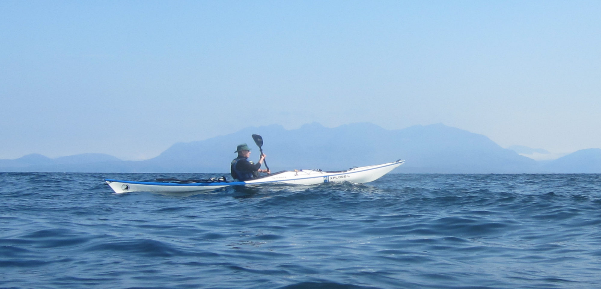
Report: A good drive and a lovely day saw us away from the old slip at Colintraive about 10.15. Flat calm at first but a light breeze picked up as we rounded the corner and slightly slowed progress. It had become clear the previous day that the original thought of getting to Ettrick Bay was simply too far and we opted instead to paddle down Bute to Ciste Point and then across to Kames and Tignabruich and up the west side. The weather and scenery were pleasant without being spectacular.
Paddling South down Bute
Landing places down this coast are limited but we managed to find a small gravel beach for elevenses/early lunch.
Route
The crossing to Kames was uneventful as was the paddle to Tignabruich. The best landing place here, although not brilliant, is by the slip/toilet block. The Burnside Bistro here has nice outside tables and good food.
Heading North
Our third stop was Claddagh Harbour; worth a visit. From there we headed straight back across to the new Sea Kayak Camp Site and Shelter opposite the Burnt Islands. The shelter and toilet were excellent but there was little/no camping areas. Presumably the intention is to carve out a grass area from the ferns but it is currently not recommended for an overnight stop.
The Burnt Islands Shelter and Toilet
Our final crossing back to the Colintraive slip was uneventful and we got back to the car just before 5pm. A very pleasant days paddling
Paddlers: Geoff, David and Jamie Weather: Bright and very breezy (F3/4)
Route: Kilcreggan, Gourock, Cloch Point, Cardwell Bay, Inverkip and v.v.
Report: “Exploration”-investigating new areas or new perspectives-is an important part of the appeal of sea kayaking. However finding unfamiliar areas for short day trips can be difficult. This route was chosen simply because the coast was less familiar than most. Kilcreggan was chosen to give us an extra hour of paddling south than from a Helensburgh launch. The launch point was about 400m along Fort Road (turn sharp left at bottom of hill at entrance of village) by the entrance of the Portkil Estate. The beach here has been cleared of large stones to allow easy motor boat launching and there is good parking. We were afloat by 9am.
The previous day had seen F5 north easterly winds and although the wind had dropped to a low F4 there was still considerable swell which led to an “interesting” if fast crossing.
Heading south by Cloch lighthouse
With a strong wind on our backs we rounded Cloch Point for our first stop of the day in Lunderston Bay by the Cardwell Bay Garden Centre. This is an excellent landing with a sand beach, seats and a large flat grass area.
Lunderston Bay (Cardwell Garden Centre)
After some relaxation in the sun, we headed on south for Inverkip in the strong breeze always conscious that every km south would be a fierce battle north. The views both north (Loch Long and Argyll Forest Park) and south to Arran were outstanding. The removal of Inverkip Power Sation and its huge chimney has improved the area immeasurably.
Heading South
After mooching around “Scotland’s Premier Marina” we decided to begin our battle back home. We progressed well and were at McInroy’s Point (the Western Ferries dock) for lunch. There is quite a good beach just to the west of the point. One item to note were the weekend “huts” perched on the edge at Cloch Point. These seem to have been built on old gun emplacements.
Looking North
After a long lunch break we paddled along he Gourock prom to the Cal-Mac terminal keeping in as much shelter inshore as possible. From Gourock e crossed back to Kilcreggan, the wind having dropped to a F3 and shifted slightly to the south. We were back by 3.30. An excellent day.
Report: The pleasure of paddling at night is difficult to explain; perhaps it is the increased sense of space and calm. Anyway this trip confirms what some of us already knew, that there is a sense of magic about it. Because of the north westerly breeze we chose the islands of Loch Lomond. Despite innumerable trips around the islands they present a real navigational challenge as all the islands and hills “blend” together and obvious through routes disappear. As an example it was never clear when we had crossed from Inchmoan and were rounding the south tip of Inchcruin. We set off at 9.30 as complete darkness descended, without any clear plan.
Route Taken
After a noisy departure (weddings at the Lodge) and a Laser Disco on Inchconnachan we entered a world of silence and calm. At the pier of Inchcruin we stopped for a break and something to eat and drink. I believe the photo may have been taken there. It was a weird contrast to the picture taken at the same pier a few reports ago.
At the end of Inchcruin we could see the lights of Luss and headed directly for them. In just about 30 minutes we were back on the beach (about 12.05). It was a wonderful night, so next time some idiot suggests, on a cold damp, overcast day, a night paddle DO IT. You will not regret it.
Helensburgh Canoe Club was formed to provide training in kayaking and canoeing and to organise trips for its members. It is, what is termed, a “risk assumed” sport and combined with the weather and water temperatures in winter, serious paddle sport activity in Winter is only really possible for those over 14. In summer this is dropped to 12 when we run a dedicated Basic Skills Course for Youngsters.
This season we are looking at the development of a Youth Squad for those over 14. This is open to those at 2 star or above level of proficiency. For those wanting to obtain that level we run a Basic Skills Course starting in September. This involves 10 Tuesday nights (at 7.30pm) in the Helensburgh Swimming Pool and a minimum of 3 open water trips. It is an ideal target for the DoE or Scout Awards. The cost is £40 for the course plus £20 for club membership.
The poor weather forecast (high winds) , unavailability and illness caused a change of time and venue from round Jura to the south east side of Coll and Tiree. Even then we expected high winds and very rough water, especially in the Sound of Gunna, between Tiree and Coll. In the event, although the breeze was apparent, the water was flat and the sun shone and shone, with over 15 hours on both days.
Just like bikes, kayaks are carried free on Cal-Mac ferries. Carrying the boats on to the ferry in Oban we learned the most important lesson of the trip; USE A TROLLEY. The ferries are big, but the link spans are even longer. With three of us we needed a minimum of 3 trips the length of both. Whilst the Oban carry-on was just tolerable, the length of the boat plus the the length of the link span at Scarinish (Tiree) was close to half a mile, and it took close to an hour of hard labour to get to a point where we could get into the water. By the time this was completed we were very tired and it was 7.30. The original plan of paddling for an hour was thereupon abandoned in favour of camping on the flat land adjoining the Cal-Mac office (and the water supply and toilets) and a trip to the pub.
Camp Site 1
A pleasant enough evening followed with a lovely walk of just over a mile and we turned in at about 11.30pm. At 6.45 a loud metallic clanking indicated an early shift by some construction workers at the pier, and at 7am a jack hammer started breaking up a lump of concrete. This continued intermittently for the next hour and a half. By 9 am even Ken was ready to depart.
Beach by office, Tiree
The most memorable feature of the islands are the glorious beaches, huge, like Gott Bay or tiny coves tucked between the rocks. On Gott Bay can be found the extraordinary cottages peculiar to Tiree. These have rounded roofs covered in pitch (or thatch) and huge walls to deflect the constant wind that blows over the island.
The breeze was continuous and would have made any attempt on the North West coast untenable, or at least very unpleasant. For us it simply provided cooling of an increasingly hot sunny day. We got across the potentially difficult Sound to the island of Gunna for lunch.
Gunna has lovely beaches and a large flock of completely black sheep. It also has a cottage that is not new but fails to appear on any map. After lunch we paddled on to Coll and climbed to a trig point to look at the north side, confirming again it was not possible.
The North Coast of Tiree
After a snooze we pushed on south. At this stage Hugh claims to have seen a Basking Shark. The paddling was wonderful with lots of seals and islets to meander around and through.
The look out for a campsite with drift wood for a fire led us to a small cove near the mouth of Braccadale Bay. A leisurely meal and an excellent fire preceeded a good night’s sleep.
Camp Site 2
The next morning we had a very casual (and late) departure for a short day paddling a wonderful coastline in fantastic weather. Even the breeze dropped. Our first stop was Braccadale Castles (old and new) the ancestral home of the Laird of Coll.
Old and New Castles
A lot of money appears to be flowing into the castles to provide holiday accommodation. In the weather we had, it is difficult to imagine anywhere nicer.
We paddled on surrounded by seals with excellent views to Mull, Ardnumurchan and Rhum. At one point an Otter ran up a rock just in front of us, saw us, turned and ran down back to the water.
After a great afternoon, the only small problem to be solved was how to get the kayaks back on to the ferry. On the route out we had inspected the pier at Arinagour (Coll) for good, indeed any, landing points and potential camp sites close by (the ferry was at 9.40 the following morning). After much discussion it appeared that the only possibility was a landing on the rocks at high tide or a walk of a mile plus from the village. Given the choice of high tide at 5.30 pm and a ferry due out at 7.20 pm or high tide at 6 am the following morning and a 3 hour wait we decided on the former. A trip up to the village and the pub, then back to the pier and a surprisingly easy lift out over the rocks. Note that this would only be an option in the very calm weather we experienced.
The ferry was late and, by the time we had carried the kayaks and gear the length of the boat and up the ramp, it was after 11 p.m before we were ready to get going for Helensburgh.
This was a great trip to three wonderful islands but access to and from the ferries is real problem. A trolley would have halved the time and quartered the effort and would have been essential on Coll in poor weather. Carrying a trolley (or storing it) is problematic and subject to further investigation.
Report: This was a midweek paddle arranged at short notice (hence numbers). From Largs Marina (an excellent location with easy car parking and a slip) we headed for Millport. The westerly breeze was suprisingly strong. After a break at Millport we rounded the point with the intention of crossing to Bute. By this time the channel was covered with white horses and we were worried that the wind might get even stronger so, regretfully, we decided on a simple circumnavigation. It was quite a wet paddle but the wind slowly eased. We took a break at the cafe (and an ice cream) before rounding
Beach by cafe on west of Great Cumbrae with Bute behind.
the north end and heading back to Largs. A good day.
Weather: Calm. Overcast with summy intervals and periods of heavy rain in evening.
Report: Departed from Aldlochlay close to noon Saturday and paddled to Inchonnachan for lunch and some exploration of the old summer house..
Departure
From Inchconnachan we headed over to our camp site on Inchtavannach and pitched. After some debate we then proceeded on a late afternoon paddle around Inchmoan before dinner. During the paddle there was heavy rain which continued on and of throughout the evening. Most of the youngsters decided on a swim before drying out in front of an excellent fire. A pleasant, if occassionally wet evening was had by all.
Sunday was calm and sunny. We left the camp site about 10.30 and paddled over to Inchgalbraith and its ruined castle.
At the castle window
A slow leisurely paddle back to Aldlochlay followed, arriving just before noon. A very successful conclusion to a successful course.
Weather: Lovely but windy on Saturday getting less windy but more cloud as weekend progressed, with heavy showers day and night.
Route:
Report: Slightly late we left Helensburgh at 7.30 aiming for the 10.20 from Lochaline to Mull and made it easily. A rather slow drive across Mull got us to Ulva Ferry around 11.30 and on the water at 12noon.
Departure ;Ulva Ferry
There was a brisk northerly F4 blowing but a decision was nevertheless made to go on the north side of Ulva, with the option of cutting through the channel between Ulva and Gometra if there was doubt about the crossing to the Treshnish. So it proved and we stopped at the wee bridge joining the two islands for a break and because the channel was still dry.
Bridge joining Gometra and Ulva
By the end of lunch the channel had still not filled sufficiently so we waded through. Almost immediately after resuming the paddle a Sea Eagle appeared soaring above us.
Sea Eagle above Ulva
The original plan had been to creep up the end of Gometra before crossing but it rapidly became clear that we would need to wait for the wind to go down. We stopped at a potential camp site with a view north with a poor landing on wet, seaweed covered extremely slippy rocks and waited in the sun
A snooze in the sun
By 6pm it became clear that progress was not going to be possible and this was to be the camp site. Here is where the Strops come in. Hugh had designed a pair of lifting strops that proved a godsend in getting the loaded boats up (and down) over the terrible beach. These proved invaluable.
Strops in Action
If there are four of you and you have strops, the camp site is strongly recommended with large relatively flat area, good pegging and a supply of driftwood. The latter provided the fuel for a good camp fire with turn in sometime after 11pm with an agreed rise at 7.oo for a departure at 8.30. Otters also frequent the area.
The Campsite (with Staffa in background)
Overnight there was heavy rain which damped both tents and wind. However it stopped at 7 and stayed away most of the morning. We headed directly for Carn na Burgh into the increasing wind. Although both islands have fortification and history both have terrible landings with Beag almost impossible. The views however were fantastic.
view form Carn na Burgh Beg south to More with Lunga in distance
Some History: The two islands have a long history as part of the boundary between the Norse and Gaelic cultures. Easily fortified they were used in a number of clan battles including the battle between the Maclean’s and Argyll in 1680 that ended with the supremacy of Argyll. Its last use was during the 1715 rebellion when it was occupied for the Jacobite cause by the MacLeans whose chief had been imprisoned by Argyll.
The paddle was then south to Lunga past Fladda and a host of islets and skerries. The wind had been picking up all morning and winds caused a few flutters as the kayaks surged forward. The landing on Lunga was again on rocks although they were somewhat smaller. There we joined yachtsmen and tourists off the multiple boats that operate from Fionphort, Bunessan and Ulva Ferry. The attraction was the magical puffin colony where hundreds of Puffins in their Sunday best parade for the camera.
Aiming for the Photo Competition
Puffins and Wildflowers
Puffins and Kayaks
The numerous tourist boats were eventually joined by a Cruise Liner!
Cruise Liner Calls
From Lunga we headed directly to one of the most incredible places in Scotland. Staffa is formed of nearly perfect hexagonal vertical columns of basalt sandwiched between sandstone and at its most magnificent has three large sea caves.
Mackinnon’s Cave
Mackinnon’s Cave is the largest with a wonderful vaulted entrance. The Boat Cave is the deepest and houses a pair of nesting guillemots. In their distress at being disturbed they accurately dive bombed Ken with rather smelly faeces. Ken alone was not amused at this sign of good luck.
One amazing phenomenon at this point is the tilting ocean. The columns are vertical on the sandstone but the sandstone layer is slightly tilted. It seems impossible for the brain to cope.
Sloping Seas
The third cave, Fingal’s, is the masterpiece with vaulting throughout its length.
The public are able to access the cave by a path at the base of the basalt. The tourists during our visit not only had the magnificence of the cave but 5 beautiful sea kayaks to admire.
The path to Fingal’s Cave
We had a quick break at the only “beach” at Clamshell Bay, another rough rocky landing. After much discussion we headed back to Gometra in degenerating weather, reaching there about 6pm. It had been a fantastic sea kayaking day with two amazing natural phenomena and around 20 miles of excellent kayaking in fantastic surroundings.
Monday promised a relatively short paddle along the south side of Ulva to get us home for early evening. The cliff scenery was excellent the whole way and the wind , now from the South, had little impact. We stopped at a private bothy at Cragaig used by at least one kayak club. Perhaps a winter trip?
The Ulva BothyBoats at the Bothy
We arrived back at Ulva Ferry at about 1pm and decided to take lunch in the Boat House cafe on the island. This was excellent (if slightly expensive) and the Heritage Centre (Free) was well worth the 2 minute walk from the cafe. In stark terms it described the clearance of Ulva/Gometra from a populationof 850 at the start of the nineteenth century to 15 in 1981.