Morven, Sept 2015

Paddlers: Dave, Tim and Geoff

Weather: Grey, Overcast with rain late on. Light wind F1/2

Route:
route

Report: Wednesday was lovely, Friday was near perfect but Thursday was horrible. Despite a forecast of sun we saw none but did have heavy rain.

The trip started well with fantastic views of Glencoe and swirling mist

1-IMG_0672

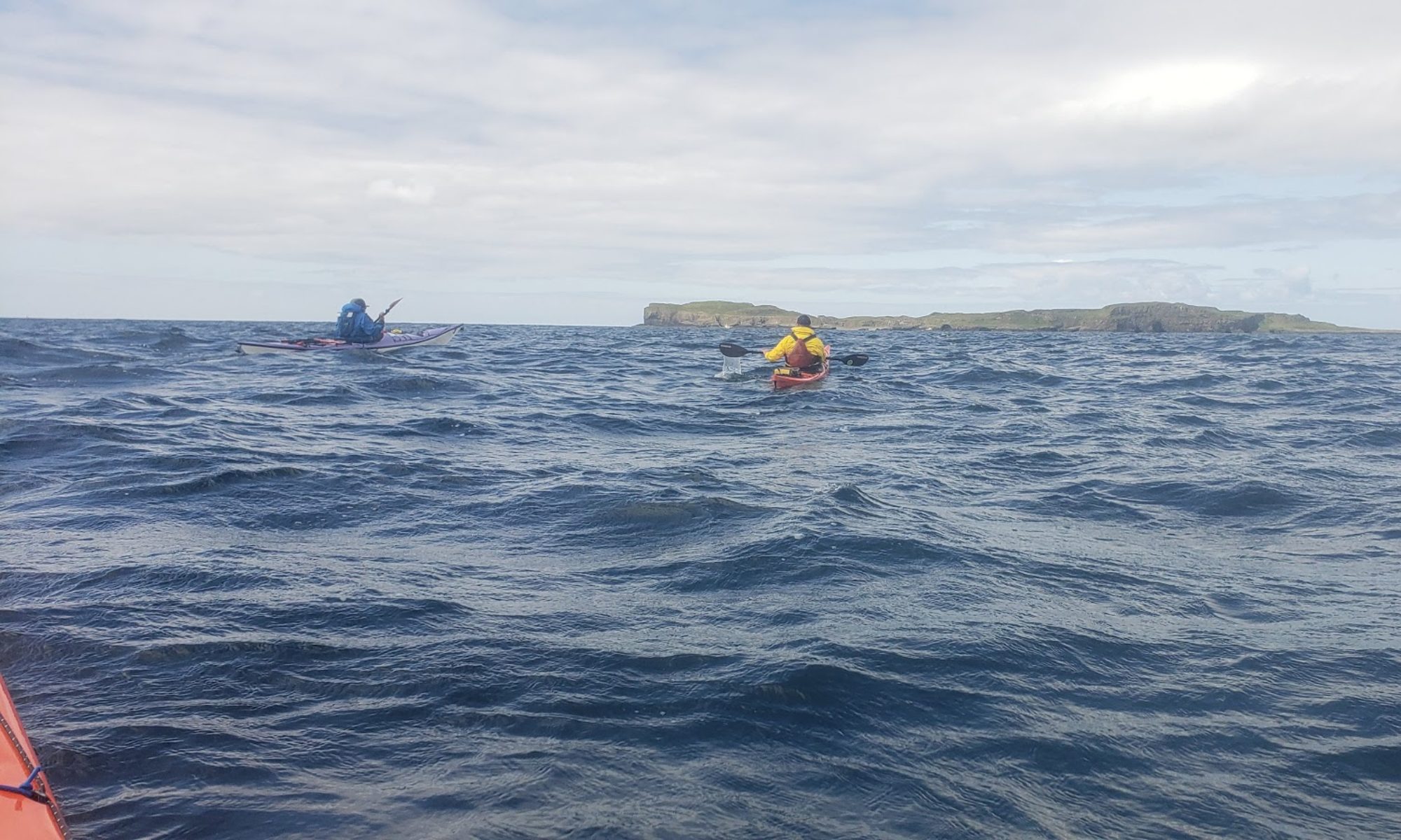
The chosen launching point was the slipway just under Ballachulish bridge. Parking was easy and the water was high, providing an easy launch into a fast stream (emptying from Loch Leven into Loch Linhe). The paddle across past Onich and Sallachy Point was pleasant and uneventful.

IMG_0676Our coffee break on Morven gave superb views back to Loch Leven and the mountains.

1-morv 122

We then headed south past Inversanda before turning 90 degrees to cross Loch Linhe by the shortest crossing. From bright grey the sky was turning dark and rain was seen in the distance up the Great Glen. Another lunch stop gave super views back towards Morven

2-morv 125

The Loch was almost completely empty and the weather got progressively worse. On the last leg it moved from dreich to wet to pouring. We got back to Ballachulish on the incoming tide at around 16.30 having covered some 24km in around 5 hours of light paddling.  The slip was just starting to get covered and it is clear that to use this launch point you must a) go with the tidal stream (runs at >4kn)  and b) avoid low water.

It was a pleasant paddle in an unexplored area and overall it was a good day.

Cumbrae 10_9_15

Paddlers: Geoff, Dave, Pete plus 3

Route: Largs Marina clockwise round Great Cumbrae

Weather: Sunny but windy (F4/5)

Report: The original objective had been Little Cumbrae but the battle south towards Millport into the wind soon put paid to that idea. It was thought, initially, that it might be too windy to experiement with sails but in fact it was near perfect conditions for the run north on the far side of the island as these two photos from Pete show.

cumbrae sailing 1

cumbrae sailing 2


Some claim kayak sailing is cheating! From my still very limited experience, any physical effort lessened is matched by the mental effort increased; a sea kayak running downwind is not the most stable of craft even without a flapping sail.

After rounding the north end, the battle back up to the marina was as difficult as expected but suprisingly satisfying. This was a really good day.

Kerrera August 2015

Paddlers: Hugh, Geoff, David, Tim and Robert

Weather: Clear, Sunny or light, high, cloud. Wind F1/2 increasing to F3/4 at end of afternoon

Route: 


kerrera

Report: With high winds forecast further south on Jura, the proposed trip was altered to a trip around Kerrera. This proved ideal as 3 of the 5 paddlers had not been before and it was a lovely trip on a wonderful day. The wide sand beach at Ganavan is 2 miles north of Oban and is a perfect launch spot with excellent parking, toilets and a wide slip. Parking is a modest £2 for 24 hours.

The Beach at Ganavan

The sceney is magnificent with Lismore and Morvern to the North, Mull to the west and Kerrera to the south. The odd photogenic ferry also helps

02-2015-08-18 11.11.3104-2015-08-18 11.11.4405-2015-08-18 11.11.57

Our paddle south was quite fast and we overshot our intended coffee beach at Slatrach, although the next sand beach at Barr-nam-boch was extremely pleasant. After lunch we paddled on round the point heading for  Gylen Castle.

Heading South. The Garvellachs are directly ahead

Once again we spurned the poor beach to the west of the promontory in favour of the worse beach to the east.

Gylen Castle
Gylen Castle
10-2015-08-18 14.47.57
The East Beach
OLYMPUS DIGITAL CAMERA
Looking South from Castle Gylen
In the castle
Fashion Show in the Castle Fireplace
The castle looking south at the top
12-2015-08-18 15.13.03
A difficult launch

500m up from the castle is a lovely tea room; thoroughly recommended.

Tea Time in the warm sun

The journey north was assisted by a rising tide .

09-2015-08-18 11.12.38
Heading north

At Oban, whilst Hugh, Tim and Robert decided to mix it with the ferries David and Geoff decided coffee was more inviting and pushed on to Gallanach arriving about 6pm. The tidal flow and the increasing breeze made the final couple of miles quite interesting (bouncy) and rounded off an excellent days sea kayaking.

East Bute, 12/08/2015

Paddlers: Mel, Geoff

Weather: Bright but overcast, light wind F2

Route: Inellan, Toward, Askog, Mt Stewart, Kilchattan Bay and vv.

east bute

Report: The “normal” route for paddling around Bute is either Largs, Great Cumbrae, Bute or Colintraive for the west coast. With traffic, however, it is quicker, and certainly pleasanter  to go via Dunoon than via Largs. We parked at what appeared to be an ideal spot just south of Inellan with easy access to the water and toilets. As will become clear, in reality it is NOT a good spot. We got away around 10.30 and headed south into the breeze, with a first point of call being the hamlet of Askog.

1-2015-08-12 10.25.08
From Inellan to Toward
2-2015-08-12 11.03.26
Looking towards Bute and Rothesay


The coast on this section of Bute has a selection of large, impressive villas culminating in Mount Stewart (which cannot be seen from the water). Askog is a lovely place with beach and views to match.

Askog
Askog
Looking North from Askog

After a break we continued south towards our target, Kilchattan Bay. Of particular note was a yacht, which because of the mast height, we initially mistook for a radio mast.

Lionheart
Lionheart

This gigantic yacht is described thus: When delivered she’ll be the largest J-Class superyacht in existence, with 17m overhangs on an LOA of 43.4m. ABS classed and MCA compliant, she will be able to accommodate eight guests in four cabins.Lionheart is currently for sale as a joint central agency with Will Bishop at Yachting Partners International and Hoek Brokerage, asking €14.9 million.

Although moving quite quickly we had no time at Kilchattan Bay before turning for home.

KIlchattan Bay
Kilchattan Bay

After our second break  on the lovely sandy beach beneath Mt Stewart, we headed on north towards Toward Castle. We were entertained en route by seals and 2 dolphins whilst dodging the ferries that criss-cross between Wemyss Bay and Rothesay, one each way per hour.

Looking north twoards Toward Castle
Interested Seal
Interested Seal

Upon arrival back at approx 5pm we found that our “ideal”car park was anything but, being at the end of a triangle of rocks reaching out around 500m. This made any landing a matter of a very long carry over terrible rocks and boulders. In the end we abandoned this and went about 500 m north to the top of the triangle, where there was a lay-by and a short carry. From there it was a quick walk back to fetch the car. This landing/packing up process took the best part of an hour.

In summary this was a pleasant, if relatively unexciting, day paddle. We covered some 35km (20 miles) in around 5 hours; the normal relaxed 3.5-4knots.  Worth recording??

Loch Lomond Camp 25th/26th June 2015

Paddlers (Aldlochlay): Geoff, Euan, Mike(H), Stewart, Stuart, Adele, Robin; Ross M, Matt E, Sam S, Jenny, Eva, Rosie, Bella, Jess, William

(Duck Bay): Hugh, Tim, Francis, Jeanette

Weather: Fine , light breeze on Saturday, heavy rain at night, mixed and breezy on Sunday

Routes:ll_camp_2015

NOTE: If you want a larger version of any photo just click on it. Then to save it right click amnd select top option.

Report: 20 members ventured out on a weekend with a forecast of wind and rain. Hugh’s sea kayak group enjoyed a paddle over to Port Ban on Inchcailloch where Hugh demonstrated that quality catering is quite possible. They then travelled on to Inchconnachan where they met up with the Young Beginners camping group.

Leaving Aldlochlay
Leaving Aldlochlay
Heading forInchtavannach
Heading for Inchtavannach
Leaving Duck Bay
Leaving Duck Bay
Rounding Inchtavannach

11698664_10153408085218564_4495002382831309109_n


Wallaby
Wallaby
Campsite
Campsite

After the main group departed, the sea kayakers went Wallaby hunting and were rewarded with a sighting. Meanwhile camp was being established and dinner cooked.

11227553_10153409541693564_1565624171147185380_n

After dinner the sea kayakers departed for the long trip back to Duck Bay whilst the main group embarked on a paddle aroundInchmoan including a visit to the castle atInchgalbraith. During the trip Stewart joined us for the evening. We eventually got back to the camp about 9.30 and had more to eat and drink around the camp fire.

11181887_10153409541778564_4187870479029752771_n

Returning to Camp
Returning to Camp

During the nighjt there was torrential rain whcih stopped just as we got up at 8am.  Tim and Robin arrived around 9 because of the terrible forecast of wind and rain. However, although we had both, neither made the return trip unpleasant.

Le Grand Depart
Le Grand Depart
1Amidsummer2015 005
Heading Home

11694940_10153409541923564_9210299383978427092_n


We were back at 11.30 and the sun shone as we loaded the cars and trailer. Another very successful canoe camp. Thanks to everyone involved.

River Leven 11/6/15

Paddlers: Euan, Geoff, Tim, Allan, Tim L., Mike H., Adele, Stewart, Jess, Rosie, Bella, William, Matt L.,  Matt E., Alie, Eva, Jenny (17)

Weather: Excellent

Route: Balloch (Rowing Club)-Dumbarton (Old Bridge)

map_leven


Report: Equipping 17 and getting cars to the end point took some time but we eventually got away just after 19.30 expecting a 2 hour trip.

On the slipway at Balloch

However the Loch was high and the river was full and running at over 3mph. The level affectively washed out the normal small rapids and replaced these with a worry about catching capsized paddlers and boats.  In fact only Stewart had an early bath, the youngsters coping extremely well. So well that we reached Dumbarton just after 21:00. The river was quite beautiful as can be seen from the following photos.

1-level21-leven51-Leven11-leven4

It was an excellent trip; well worth the hassle of the initial hour.

Loch Lomond 10/6/15

Paddlers: Allan, Tim & Geoff

Route:map_ll62015

Weather: Glorious. Breeze (f2/3) from SW

Report: A lovely relaxing paddle of around 24km. Lunch at Port Bawn and a pint in the pub on Inchmurrin.

Launch at Duck Bay
Balmaha
1-2015-06-10 11.28.38
Off Port Bawn Beach

Islands of Loch Awe

Paddlers: Geoff, Hugh and Robert

Weather: Bright but windy; F3/4 from west veering south west

Route: lochawe 2015

Report: With forecast F4 winds after a week of wind , the open sea was rejected as an option. The islands of Loch Awe offer an alternative, extremely attractive and “historic” day trip.

Getting to the water is a challenge but we found a short steep track off the Inverary road down to an abandoned piece of the road where there was good parking and a relatively short but steep clamber down to the water. The beach was scattered with sharp boulders as is the whole loch.

Launch point with Ben Cruachan in background

We paddled the first stretch to Eilean a’Chomhraidh into a strong westerly. The island itself has several sandy beaches and a number of attractive camp sites. At the west end there is a ruined church and a graveyard where the last two Dukes of Argyll are buried. The whole island was covered in bluebells and a roe deer kept us company for a time. A visit is strongly recommended.

Beach at the island.

We then paddled on to the hotel at Ardanaiseig passing two crannogs en route. Crannogs (artificial islands which formed the base of prehistoric huts) are a feature of the loch with no less than 5 in the vicinity. Because one of our number had inadvertently left his lunch behind we decided not to stop and pushed on towards the island of Innis Chonain which is joined to the mainland by a short bridge. There are 3 or 4 private properties on the island. robert, lookin west down the Pass of Brander

Landing on the shore at Lochawe village is difficult because of the railway. We eventually found a rough beach at the far end of the railway station  which provided access via the platform to the pub (closed) and the small shop. A pleasant lunch was had by all.

The next stage to Kilchurn Castle passed quickly with a strong breeze at our backs. The views up Glen Orchy were wonderful.

View up Glen Orchy
View up Glen Orchy
Hugh apracing Kilchurn Castle
Hugh approaching Kilchurn Castle

Kilchurn Castle is another “must see”. Situated at the end of a broadened causeway (KIlchurn was originally on an island ), it is a complete ruin but some inspired steps and platforms take the visitor right up the towers. Excellent information Boards provide a history of the castle and the devious dealings of the Clan Campbell. The views of and from the castle are superb.

OLYMPUS DIGITAL CAMERA
The south elevation of Kilchurn Castle

The final few miles was hard work into a strong F3/4 wind. Perhaps it simply added a challenge to make for a thoroughly satisfying day.

Far North West, 13th-16th May 2015

Paddlers: Geoff, Hugh and David

Location:

Far North West


Weather: The dominating feature of the trip was the wind. The forecast was F3/4 with occasional drop to F2 and some gusts at F5. In reality it was a notch up at F4/5 which made the idea of a paddle of 5 miles into it extremely unattractive. On the Friday the wind was forecast to rise after lunch with persistent rain and so it transpired.

Report: It is a long way to the North West of Scotland. Despite a prompt start at 08:30 from Garelochead we did not arrive at the Handa Island ferry point until 3pm. The residue of an Atlantic storm plus strongish winds and a counter tide suggested that our original plan of a short paddle across the Sound was not sensible. Instead we crossed to Loch Laxford for pleasant afternoon/evening trip heading into a strongish easterly breeze.

Loading at Fanagmore
Heading across Loch Laxford

After a fairly lengthy search of the upper loch we selected a camp site, got a camp fire going and had a meal. It was a beautiful evening but with a clear sky and with a bitter east wind, temperatures dropped quickly.

P5140005

03-far_north_west 006


A freezing night was followed by a wonderful day.

04-far_north_west 008

The trip back across Loch Laxford was not comfortable. The strong cold easterly wind (F5) was at our back, the boats were less than stable and hands quickly became very cold. At this stage it was clear that Handa was not possible so we headed south for what we thought would be the sheltered GlenCoul which has Britain’s highest(and most inaccessible) waterfall at its far end. However this loch was covered in white horses and a 4.5 mile slog into the wind was not desired.  With paddling off on what was otherwise a glorious day we decided to return up North to visit what has been called Britain’s most beautiful beach at Sandwood Bay. Click here for further information. The 4.5 mile path to the bay is extremely good and the beach is indeed breathtaking.

On path to Sandwood Bay
Sandwood Bay
Sandwood Bay
On Beach with stack in background
Contemplating the Surf


Back at the car we headed south again looking for either a moderated wind for a paddle up GlenCoul or at least a camp site close by. We got neither and after a drive along one of the most difficult roads in the UK we found  lovely site at the top end of Loch Nedd. This had everything, including shelter from the endless wind, flat ground and firewood.

07-far_north_west 012


Dominating the area is the mountain bvlock of Quirag, shown here in the evenign light
Dominating the area is the mountain block of Quirag, shown here in the evening light

The morning was overcast but less windy. However with the forecast change at lunch we decided on a trip up Loch Nedd and along to Oldany Island. This proved to be an excellent choice with interesting cliff scenery, many wild seabirds, seals and a lovely beach on the island.

Heading for a large sea cave a long way from anywhere
Looking out from Cave
The beach and bothy on Oldany
Boats on the Beach
Boats on the Beach

Whilst on the island the weather became noticeably worse with a few drops of rain, so we quickly headed back up Loch Nedd to the car for the long, long journey home.

With none of the original targets achieved the question is “was it worth the travel up there?” The answer is undoubtedly yes. The scenery is fantastic and the paddles and walks we did excellent. Overall a wonderful trip