Report: We met at the car park just north of Cove. The initial crossing was to the pier at Blairmore. It is sad that there is no service to the pier after spending quite considerable sums to rejuvenate it. With the closure of the hotels at Carrick Castle and Ardentinny and no water service the future looks rather bleak for this part of Argyll and Bute.
Blairmore Pier
We then headed north, passing the “new” wreck, landing just past the caravan park at Ardentinny for a quick break.
Time for a break
The uneventful last leg was straight back across the loch to complete a 10 mile circuit.
Report: A good turnout on a dullish evening did the annual trip down the Leven. This year the flow was quite limited and in the lower reaches was completely negated by the incoming tide. As a consequence we took almost 2hr 30 mins. However there was enough water for an enjoyable experience and the rain held off.
Report: The weather forecast was not great with heavy rain and very strong winds on the Sunday. More than one person was expecting cancellation but, because of the relatively sheltered nature of the planned trip the decision was made to continue. Consequently the group gathered at 2pm and after the usual problems of beginners fitting their gear into boats, we set off for Inchconnachan for a wallaby hunt.
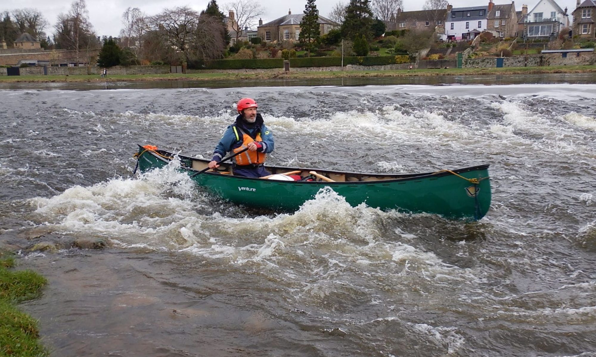
Fleet on the move
At the normal site the group split. Stewart, Geoff and Eleanor were lucky enough to spot one in the dense undergrowth, purely because it moved as we approached. There is one in the next photo.
Spot the Wallaby!
Despite the cloud cover it was dry and the views, as usual were fantastic
Down the loch from the Inchconnachan beachStuart and Rachel
The weather stayed dry as we rounded InchConnachan and headed for our camp site on Inchvannach.
On arrival tents were pitched, barbeques lit and a fire built and lit. Nat and Robin erected their Gazebo which proved very popular when the rain arrived. Stewart and Geoff, meanwhile, erected a conical shelter over the fire.
After food Geoff, Stewart and Eleanor had a short trip to pick up Hannah. During this trip it began to rain very heavily and continued off and on throughout the evening and night. Despite the wet and because it was becoming horribly midgy, most went out for an evening paddle getting back just as the light started to fail at 10.30. A late swim was undertaken by some. All had retreated to their tents by midnight.
The Sunday morning was bright and quite dry but blustery. We cooked breakfast and were off soon after 10am
Departure from site
The paddle up through the narrows was fine but we exited straight into a north westerly wind blowing around force 4, occasionally gusting much higher. It was an important lesson that kayaking can be a challenge and that the Loch can be a very dangerous and unforgiving place. However all coped well (if slowly).
Because the wind was expected to increase during the day we had arranged to finish at 11am and duly got to Ardlochlay at 11.10. An excellent weekend.
Thursday 13th June: The Beginners will be at Luss in the canoes. I am hoping to go for a paddle but because of trailer limitations only have room for a couple of the club sea kayaks so if you would like to come and need gear you will probably need to find some transport. If you can take an extra boat please let me know ASAP.
Friday 14th: During the day and evening we are supporting a charity relay team swimming 35km (the equivalent of the length of Loch Lomond) on Loch Lomond. It now appears we will be based at either Inverbeg or Luss. If you have the time off and are interested in a paddle let me know and I can suggest times and locations to join us.
Thursday 20th: The Beginners are going down the Leven from Balloch to Dumbarton. If interested let me know so I can arrange gear.
Sat/Sunday 22nd/23rd: Beginners Canoe Camp. Leaving Aldlochlay at 2pm, returning 12 noon on the Sunday. More details (how and what to pack etc) at the pool session the previous Tuesday.
Weekend 6th/7th July: Round Lismore. Depart Helensburgh 8am, returning about 4pm. This is graded as B i.e. you should have done some longish day trips but not necessarily camped from the kayak before. Please let me know if you are thinking of coming.
Pool: From 25th June on the pool will be open access with a concentration on rolling. Cost £3 per evening as usual.
Gear: You can borrow gear from the club if it is not required for club outings. We charge a nominal £5 per seat per day provided it is returned as it was issued.
We left Ard Asaig, a couple of miles west of Tarbet, at about 11.30 having caught the morning boat from Uig and over-nighted in a camp site by the ferry port at Uig. The weather was as forecast, cold and windy with the cloud almost down to the loch. The initial paddle to the lunch break on Isay was quite tough but after lunch we hit the main swell and force 5 winds. Just as we were contemplating retreat we spotted a rock beach and landed, hoping for the weather to ease. It did not and a tent was pitched for shelter. A shelter wall, firewood and a fire followed and by the time the wind eased (7pm) we had given up any idea of further progress.
The hills of Harris close to our departure pointThe rock beachCamp Site
Sunday morning was overcast and breezy but the crossing to Taransay appeared on. After a difficult launch as we made our way out between a wave break and the shore a large otter appeared, stared and disappeared.
Taransay was featured in the BBC series Castaway in which 30 people were landed on a deserted island for a year. The identified objective was to observe the development of a community. The island is large, relatively fertile and has some beautiful sand beaches. Sheep are grazed over the whole island and there are a couple of summer holiday houses. All round it appears to be a very pleasant place.
Heading for Taransay
TaransayTaransay Beach
Objective achieved we crossed to another lovely surf beach for lunch (nice bouncy entry and exit) and then back via Isay to the car for part 2 of the trip.
Day 3/4/5 Loch Roag
Wild camping from the car was surprisingly difficult, but, after an hour driving around and a trip to Callanish Stone Circle we found a lovely picnic site above a wonderful surf beach just north of Carloway.
Callanish
Evening at Dail Mor picnic site
The camp site
Our launch site was back towards Callanish. From here we headed out for a circuit of Great Bernera.
Noticeable features of this area were the population of Great Bernera (apparently “cleared” from the mainland in the 1870s), the extensive fish and mussel farms and the stunning sand beaches. Possibly the best of them was our lunch stop on Little Bernera.
Heading for Little Bernera BeachThe Beach
Bernera Beach
After lunch we rounded the headland and into the sizeable Atlantic Swell. From there we headed to the channel between Great and Little Bernera before landing on yet another golden beach. The main interest at this beach was an Iron Age village which had lain undiscovered under a layer of sand until recently. A feature is a reconstructed house which, unfortunately was closed.
Iron Age House
After some debate a rock beach on the island of Floddaigh suggested a possible place for the night. As we left we were drawn towards a basking shrk that had apparently been in the area all afternoon. We were lucky enough to get a close inspection of the fish whose length was around 20ft.
Basking Shark
Floddaigh was the nesting place for thousands of sea birds and care had to be taken not to tread on nests and newly born chicks. There was however a mass of wood, flat ground and a stunning sunset.
Fire and Cooking on FloddaighSunset
The clear sky of the previous evening augured well for Tuesday. The first objective was the famous (among keen sea kayakers) Pabbaigh Mor. As we approached a dolphin/porpoise decided to play in front of us.
The island proved to live up to its reputation. The first feature is a large sea cave but this was of minor interest compared to the stunning natural arch.
The photos were taken at a quiet period. In fact the big swell at times generated a very exciting experience! We next sought out the entrance of the lagoon but after entering what looked like the entrance we decided the tide was probably too low so we opted for the south entrance. En route was a “gap” , confused and treacherous in the big swell. After a long period of contemplation sense won over challenge and we went round outside and then into the lagoon.
After the tumult outside the lagoon was amazing, with three lovely sand beaches and completely quiet water. It also had a wide north entrance that we had missed.
A beach in the lagoon between Pabbaigh Mor and Beag
We then decided to investigate the sand beach just 3km away at Camas Cliobh. This beach was totally open to the Atlantic so we expected some surf, but it appeared from the sea to be relatively small and canoeable. This was not the case. All of us were turned and Geoff ended up on the sand upside down.
Hugh rides the surf (detail)
Jamie views the surf
We then spent the next 30 minutes trying to work out how best to get out. The shape, frequency and power of the surf and the resulting shape of the beach made exit problematic. Just as the kayak floated it was hit by a wave, turned, filled with water and beached. What was required was a young flexible paddler who could get into the kayak after the initial wave break. Our hero was Jamie who towed the old men past the first break to allow them to escape and then managed to get his boat clear” and use the keyhole cockpit to get in. Once past the surf line his kayak was pumped out and we were all clear.
After the excitement we paddled on the the township of Bhaltos which offered a telephone box and campsite in the way of services and two more glorious sand beaches.
Hugh and Jamie on boat at Bhaltos
The ideal campsite has a sand beach, flat turf immediately adjacent, good views and a wood supply. Unfortunately the first and last are very rare and we put the fire as a higher priority than soft entry and exit. So we choose the island of Fuaigh Beag for our final camp., a very satisfactory choice.
Campsite at FuaighView from Fuaigh Mor
The final morning was a quick paddle across the east side of Great Bernera under the bridge. and we reached the launch site at around 11pm. Sadly we found a side window had been smashed, possibly by a stone from the road. We suspect the police do not really believe this either but, in any case, they were extremely helpful and found us an autoglass agent who immediately fitted a temporary window for th long journey home. If it was deliberate the locals in Stornoway certainly tried to make up for the sins of their brethren and we safely caught the 4pm ferry from Tarbet. It was a beautiful crossing.
TarbetThe Paddlers
With wonderful weather the route back must be the most glorious drive in the UK. crossing/passing five wonderful mountain ranges; The Harris Hills, The Cuillins, Glen Shiel, Ben Nevis and the Grey Corries and finally Glencoe. IT was a fitting end to an excellent trip.
Weather: Very, very windy on Saturday. Sea Fog on Sunday.
Innes, Jamie, Geoff and David at Clachan Bridge (“Over the Atlantic”)The route
Ready for Departure
Report: The forecast was perfect; Northerly force 4 to 5 to blow us down on the south flowing tide to the Garvellachs followed by a strong to gale force wind with rain when we were safely tucked up in bed. On Sunday a calm sea with a strong north flowing tide to take us back to Easdale. However nobody told Boreas and when we arrived at Easdale it was blowing 6 to 7 possibly 8. A strategic withdrawal was the only option and the new plan involved a sheltered trip down Seil Sound and then, with the wind forecast to strengthen (!), a paddle along Loch Melfort looking for the perfect sheltered camp site. And that is what we did
The Campsite on Loch Melfort
Looking west from the campsite
A superb camp fire
Depart Day 2
The site was almost perfect being flat, well sheltered and with an excellent wood supply. An excellent evening was had until the rain started at about 11.
Before turning in we had hatched a cunning plan to start early to catch the tide at Cuan Sound and at Belnahua and so at 5am we were up and by 6.15, having breakfasted we were afloat. The wind had completely disappeared and was replaced by a thick wet sea fog. The calm and quiet was ethereal.
Approaching Cuan
The passage behind Torsa was deep and flowing and the tide shifted us on at 3 knots plus our own speed through Cuan Sound and out into the Sound of Luing. By keeping close into shore we were able to easily paddle in the eddy caused by the Cuan outfall down to Cullipool.
Through Cuan Sound
Breakfast at Cullipool
Visibility varied from poor to none and we were worried about missing Belnahua as we got into the strong tides, so we decided to head south behind the skerries and then follow the islands out NE. As we got towards Fladda we were all suprised at the size of the flow and the multiple directions as it past Fladda
Tidal flows near Fladda
Belnahua is one of the two Slate Islands. It was quarried until the First World War when demand and cost associated with continuous pumping to keep the pits dry from rampaging storms led to its evacuation. The legacy of ruined buildings, flooded quarries and slate waste combined with the mist provided an eery spectacle
Belnahua
Getting the Bearing
From Belnahua we headed by compass course set to get close to land as quickly as possible but avoiding the tumble of water from Cuan Sound. As soon as we got visibility we turned and headed for Easdale, the second of the Slate Islands. Unlike Belnahua, Easdale Island has a thriving economy with a pub/restaurant, museum and village hall. On Easdale we met Andy Warrender who last year circumnavigated Tasmania and this year is attempting the crossing to Norway. He had offered us a lift to Clachan but advised paddling it round the west and north sides; advice that was taken.
As it turned out this was some of the best kayaking of the weekend with a substantial swell and superb cliff scenery with arches, caves and little inlets.
Jamie admires the cliff scenery
The time from Easdale back to Clachan was expected to be 1.5 hrs but we managed it in 70 minutes without any hurry.
By 4.00 we were packed up and in the pub for a well deserved drink after a super weekend.
Weather: Rain (Light, Medium, Heavy and Very Heavy)
Paddlers: Innes and Geoff
Route: Right Round the Loch from Dornoch Point.
Loch Eck, Long and Thin
Description: The weather says it all! Highlight was the pub with a lovely open fire to warm chilled hands and the whisky to keep us from going straight home. Seriously Loch Eck is a lovely paddle particularly for open boats with steep and high hills and lovely scenery. But when even ducks are hiding from the rain……
Paddlers: Grant, Gregor, David, Stan, Jamie, Geoff, Innes and Euan
Weather: Beautiful for most of trip. Slight breeze on last leg then rain/sleet when packing up.
Description: This was designed as a gentle paddle round the islands for those on the Basic Skills Course new to paddling. From Ardlochlay we paddled to InchGalbraith for a look at the castle and then on to the first stop on the beach at Inchmoan for an extended (early) lunch in the sun. After a change around between canoes and sea kayaks we paddled on through the narrows to the Wallaby beach on Inchconnachan for a second break and a short safari. We were extraordinarily lucky in seeing a wallaby grazing in the sun in the usual area. At one time we were within 2 metres of it. Unfortunately we did not get the the photo evidence from a phone that we had hoped. Another equipment change and then on again back to Aldlochlay.
This was a thoroughly enjoyable trip in ever wonderful scenery with all the Beginners using both sea kayaks and canoes. Even though I have done the trip multiple times it never palls,and that wallaby was icing on the cake.
Overcast with occasional breaks in the cloud for weak sunshine. Cool to Cold. Calm or very light wind from NW. Overnight (from about 6pm to 10am ) there was a wet cloudy mist that made a dark night even blacker.
Report:
A clear drive from Helensburgh saw us at Morar in about 3 hours. Easy parking just up side road from Morar and an easy beach launch.
The scenery was superb with wooded islands at the west end and huge steep fiord like mountains at the East.
The Beach at SwordlandThe PathThe top of the path to Tarbet; looking to Loch Nevis
At Swordland we investigated the popular portage across to Loch Nevis. The surface is OK for large wheeled carriers but it is very steep. Not to be taken lightly.
From there we ventured on to the far end of the loch and the MBA bothy which, for some unknown reason, is named Oban.
End of the Loch
The Oban Bothy
As bothies go this was in the excellent category, dry with a good fire and a wood store. For the next hour or so the woodstore was filled and then the fire lit against the cold and damp now enveloping the bothy.
There then followed a good meal, a few drams and some stories. It is worth noting the remoteness of the bothy. The nearest habitation is Tarbet with a population of 4 and no road to anywhere. The nearest road was our starting point 12 miles away without a path. Indeed there were no established through paths in any direction. We estimate that we were the only people for around 200 square miles.
At 10 pm it was off to bed.
The morning broke misty and wet but gradually dried and brightened up. By the time we left, just after 10am conditions were excellent with a flat calm instead of the expected breeze.
A gentle paddle brought us to some lovely sand beaches at Camas Luinge. Indeed there were good beaches and camping spots right along the loch. After a coffee break we continued on to Lettermorar. The croft here seems to have been deserted about 20 years ago. Sadly it appears that the whole loch community including Kinlochmorar and Swordland has gradually disappeared over the last 50 years leaving only the Bothy and a couple of summer cottages.
From here we paddled on to the islands where we stopped for lunch.
A final paddle back to our launch point saw us at the cars by 03.30pm, away by 4pm and home at 7pm (unless you stopped for the excellent fish and chips at the Real Food Cafe at Tyndrum).
Total miles covered in the weekend was 24. Overall this proved to be a perfect winter trip up an unexpectedly beautiful loch. Recommended.
Thurs 6th: Midweek Paddle. Meet Cove 10am. Contact Geoff (674966) or email for further information.
Sat: 8th : Lower Orchy. Grade 2 river. Contact Grant if interested.
Sunday 9th: Beginners Sea Paddle. Meet RNYC 10am.
Wed 12th: Xmas Social. Meet Commodore 7pm for meal or join group at 8pm plus for a couple of drinks.
January
Tues 8th: First Aid for kayakers. Pool at 7pm. Instruction/Discussion on what can happen and how to deal with it. Covers topics like Hypothermia, Asthmatic Shock, Hyperventilation, Heart Attacks, Breaks and Dislocations. Practical sessions in pool on dealing on water with unconscious casualties, exhaustion, broken or dislocated arms.
Sat 12th: White Water Safety and Rescue Course. Location tbc
Tues 15th: Adult Basic Skills (Start of 10 week course). Pool