Report: The journey to Colintraive featured a lot of damp as we passed through cloud en route at the Rest. At Colintraive the normal old jetty was blocked off to build a new large ferry car park so we headed on towards the church, eventually parking on a lay-by adjacent to the beach. Although gloomy the scene still had beauty
After passing through the Burnt Islands we rounded the point and travelled along Bute’s unknown north west coast
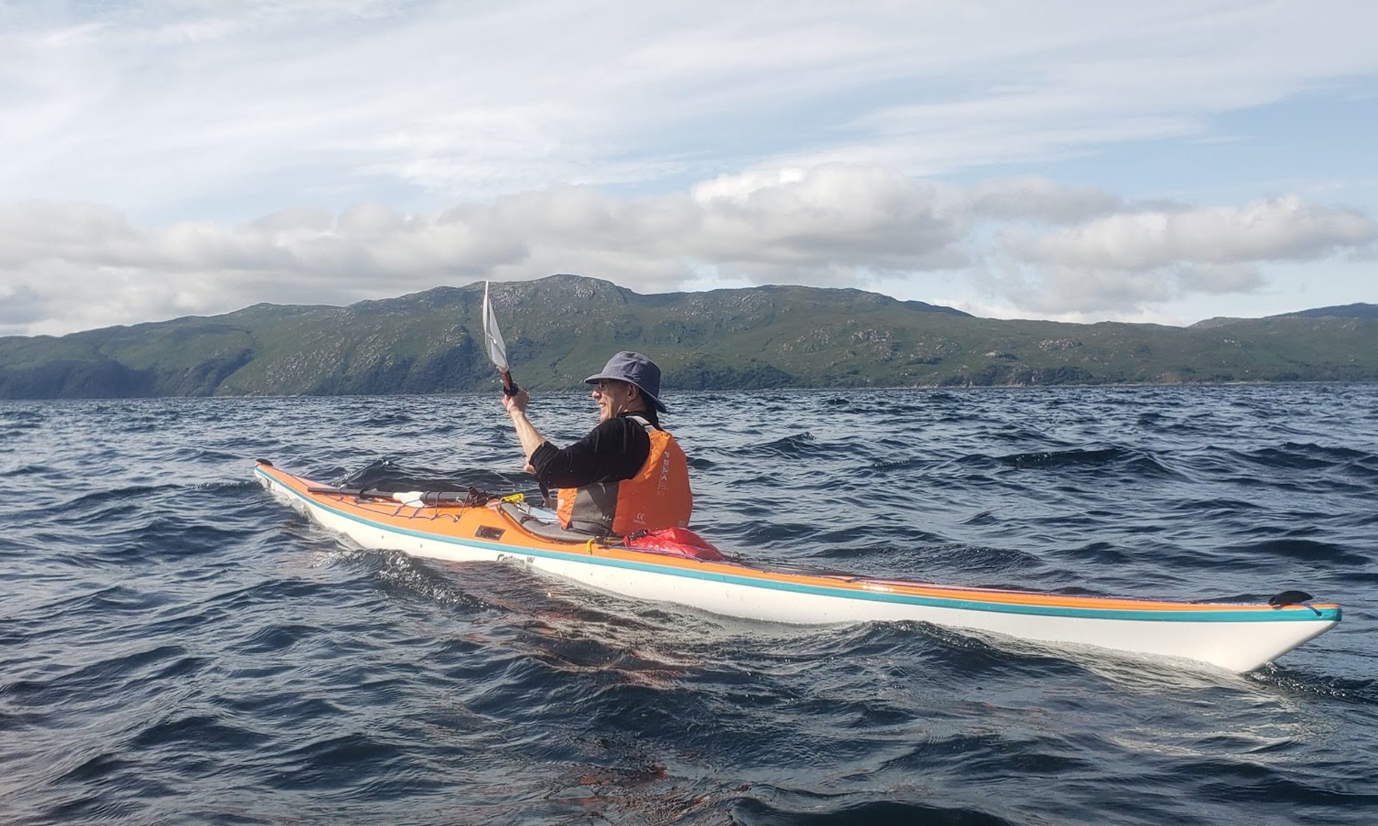
Our first stop was at a small beach almost opposite Kames/Tignabruich
Lunch over we then headed for Kames hoping to see an ice-cream sign but sadly none were viewed so we headed north again. A short on-water break in the natural harbour and then west to the marked fort on the most northerly of the islands. When we arrived at the islet we were met by a cacophony of gull cries and the sight of large furry chicks scuttling across the rocks. With no “fort” apparent we decided to leave the birds in peace and headed for a beach on the mainland. On the beach were some model houses in concrete and the statue of a small boy.
Just off the beach was a small cottage with two large heads made of wire and some tiles; it slowly dawned that we had stumbled upon the Caol Ruadh Sculpture Park (http://www.scottishsculpturepark.com/about.php) . Some of the exhibits were wonderful, others such as a pile of rocks and timber in the middle of the lawn, were problematic. The argument on the nature of art was encapsulated on a debate about a blue and white hammock just on the shore.
From the park we headed on down through the narrows back to our start. Despite the weather it had been a beautiful, calm, relaxing paddle, thoroughly enjoyed by all.
Report: John and Gordon had organised this first river trip for a number of months and conditions could hardly have been bettered. A lot of rain from the past couple of weeks meant a fast and exciting ride with John getting the less experienced used to the idea of “playing” in the river; diving behind rocks etc. The entry point at the meadows car park in Callendar is near perfect.
The first “white water” came almost immediately and continued with little respite down the whole river.
Despite numerous opportunities everybody coped extremely well. Stewart managed to fall in on exiting from behind a rock into the main stream but otherwise all of us survived if, on occasions a little wet as we crashed through.A video of Chris playing in the river can be found at https://youtu.be/09TuvB4HmIY
The Torrie Falls are the only significant rapids on the river. They are shot on the left of the river and, on this occasion were very bouncy.
The Deanston Weir, however, is a more serious proposition and the normal advice is not to run it. The weir runs diagonally across the river. To the left is an overflow channel that was a mass of dangerous water with concrete blocks to ensure death. To the right is a fish ladder, a series of concrete steps not canoeable. The main flow runs down a shallow concrete ramp and over a small drop, but at the bottom on the right becomes a dangerous hole. On the left there are two steps where a jam is a real possibility. If one can keep the line right down the middle then there should be no problems but keeping that line looked problematic when scraping down the concrete slope. Going sideways over the lip, though small, looked uncomfortable. After thorough observation and much discussion it was decided to portage; a long and not very comfortable trudge.
The Exit point is about a km further on just before the bridge in Doune. On the left after a steep climb from the river there is the car park.
The logistics of the trip worked perfectly and everybody returned home looking for the next trip. Meanwhile Colin has turned up a report of kayakers being airlifted off the weir (http://www.bbc.co.uk/news/uk-scotland-tayside-central-15148778), rather confirming our judgement.
Map: (click on map to enlarge, left click to copy/download)
Weather: Grey, wet and windy but this session it was a strong F5 from the SW
Report: Originally planned as a Beginners trip to the Sugar Boat the conditions made that impossible, Instead three of us decided on some rough water training and a bit of surfing. In fact paddling was a lot easier than expected and the surf hardly generated a decent run. Despite this it was an enjoyable workout.
Paddlers: Melani, Amy, Mollie, Tom, Euan, Geoff, Gordon, Kerry
Weather: Grey, Wet, Windy from North East
Report: The original plan was to cross to the Sugar Boat but the strong offshore wind experienced as soon as we left the shelter of Craigendoran suggested that might be foolhardy with beginners. Instead we paddled across to Ardmore Point. The wind and distance proved a serious challenge but a good time was had by all
Report: Another late arranged paddle the main points of interest were the use of FlatEarth sails on Pete’s and Geoff’s kayaks in fairly breezy weather and the rather dodgy landing and re-entry at at our half way lunch stop just north of Cove Bay Sailing Club
Pete clear of the surf
Sue clears the surfSails up heading for Kilreggan Pier
Weather: Quite dull at first but brightening to a glorious afternoon. Wind southerly F3
Route:
Report: We parked at the car park on the green just before Cove itself. It is not very easy to get down and launch but easy parking and loading/unloading compensates. The basic objective was to explore Holy Loch more closely than possible from Helensburgh. When we started it was dull and the breeze from the south made the Loch Long crossing feel long. Tied up at Blairmore was a large catamaran picking up two coachloads of tourists. We carried on round Strone point and up the Loch looking for somewhere good to land. Sadly, like Loch Long north it is not the most wonderful coast for kayakers. We then turned and headed for the marina at Sandbank. This proved a good choice; 3 small Cal-Mac ferries were anchored up plus a large timber carrier was loading. The marina itself was not particularly attractive but has an excellent recommended coffee shop just above the main slip.
After a prolonged break in the warm sun we pushed on past Hunter’s Quay and Kirn, lunching on a beach just north of Dunoon centre.
Lunch Stop
Another prolonged sun bathe followed. We then paddled straight back across the Loch/Firth junction, marvelling at the beauty all around us and the absolute peace than can come with sea kayaking.
We got back around 4pm having covered around 20km in a leisurely 6 hours. Another wonderful day.
A bright evening with a little chop on the surface but no wind. A short paddle and then a game of canoe polo. What better way to train.
River Leven Paddlers: Euan, Geoff, Alan, Melani, Amy and Robbie
Unlike last year conditions could hardly have been worse with incessant rain, a cold wind against us and a relatively slow river. However it was a useful introduction to skills such as ferry glides and to reading the river. Congratulations to the Beginners, particularly to Amy, for making what can be a long trip within the two hours.
Paddlers: Adele, Kerry, Steve T., Colin, Innes, Geoff and Hugh
Weather: Blustery and sunny but with occasional heavy showers of rain and hail.
Route:
Double click on maps or photos to enlarge.
Report: The wind report was not favourable so it was decided to head for the sheltered waters of Moidart. This remote and stunningly beautiful area is deservedly popular with sea kayakers, the club having been here in 2012 and 2014 http://www.helensburghcc.org.uk/wp/2012/07/05/moidart-and-ardnumurchan-july-2012/and http://www.helensburghcc.org.uk/wp/2014/09/22/moidart-september-2014/). The journey up was something of a nightmare with heavy summer Saturday traffic and the legacy (10 miles of stop/start) of a lorry crash on the A82 north of Tarbet. Launch sites are difficult and the original plan was to come in from Glenuig, but the wind acted as a deterrent so we headed for the car park opposite Castle Tioram.
One problem with the loch is the extensive sand areas as the tide falls and at the car park we faced a substantial walk over the sand to reach the water. Instead we drove up the river to unload and then put the cars back in the car park. After the major delays en route we eventually put in at just after 3pm.
On the River Shiel
It was necessary to follow the river bed through the sand flats until we could turn west towards the sea. We paddled on with the wind, stopping at a lovely beach just at the exit of the loch.
A short break and then on along the north coast of Shona to the North Channel. This section was surprisingly quiet, with little wind or swell.
The North Channel is an impressive cut between Shona and the mainland that dries at low water. We traveled in on the tide and the causeway was well covered. Rounding the south east corner we headed for our favourite campsite on an islet just off Shona.
After dinner the wind was getting up and there was the odd shower of rain. Kerry found an excellent location for a fire, Hugh erected a nylon tarpaulin as a communal shelter and a pleasant relaxing evening was had by all
There was heavy rain and wind in the night but all survived unscathed. With the frisky wind(F4 and gusting) it was decided to simply explore the loch and then head back.
It was now high tide so we headed for the memorial to the Seven Men of Moidart, prominently identified on the OS Map. We landed twice near the bottom end of the loch but both landings required a 0.5 km walk to a cairn. Unbeknownst to us we could clearly see the seven men (or at least two of them), a row of Beech trees planted to commemorate the seven men who landed in Moidart with Bonny Prince Charlie in 1745. Fuller information with photos is given at https://www.moidart.com/history-moidart/seven-men-of-moidart .
Because were worried about the loch drying we got back in the boats and retreated, landing at a small rocky beach marked as Port Bhata for our first lunch. Much to our surprise there was a number of ruined cottages, field walls etc in a location with apparently little natural resource.
From Port Bhata we headed for Castle Tioram, a spectacular island ruin at the end of a causeway that dries at low tide.
You can still get inside the castle through a small gate marked “extremely dangerous”. As noted in the latest condition report this rather exaggerates the dangers and it is worth entering to admire the various rooms and ante-chambers that still survive. Comprehensive information on design and history with lots of photos including aerial shots can be found at https://canmore.org.uk/site/22511/castle-tioram.
From the castle we paddled back to our launch site, reloaded the cars and headed back to the car park for our second lunch. The sunny, warm, windless beautiful location was complemented by a wonderful Sea Eagle sweeping and swirling around the castle. Sadly the power steering fluid in Hugh’s car decided to exit the vehicle for reasons currently unknown.
The journey back via the Corran ferry was fast and unhindered, although the weather across Rannoch Moor was as bad as anything I can remember, with lashing rain driven by storm force winds. Just a reminder of what we might have got into if we had not been prepared.
Was it worth the drive? Undoubtedly. Moidart is spectacularly beautiful even by west of Scotland standards. The camp site is close to perfect and the company was excellent. A great weekend.
Paddlers To: Amy, Mollie, Melani E., Melani K., Adam, Robbie, Thomas, Tim, Euan, Douglas, David, Allan, Geoff
Paddlers From: Douglas, David, Allan, Geoff
Weather: Bright but very breezy. Wind became strong F4/5 at around 19.30
Report: The morning forecast was for a wind F3 strengthening after 10pm to F4. The decision to proceed with the popular trip across the Gareloch for chips at the caravan park was made and at Kidston all appeared well. As we hit mid channel however, it strengthened and by the time we hit the beach at Rosneath was really blowing. All the paddlers seemed to cope confidently and well with the following sea.
A couple of test runs out of shelter convinced us that some of the beginners would not be strong enough to cope and that any capsize would mean ending back at Rosneath. Reluctantly therefore we put into place our emergency back up. Four experienced paddlers returned into the face of the wind and after a strenuous paddle got back to Kidston where they picked up the trailer and 4 cars, drove round to Rosneath and transported everything back to Helensburgh.
Lessons? We were well equipped for an emergency and had an escape plan so there was never any danger. However a look at the met office weather forecast at 5pm would have warned us that the earlier forecast was misleading, and we could then have relocated to shelter at the RNCYC.
Weather: A relatively cool grey day brightened as the day wore on. Wind light but present.
Report: We had a pleasant paddle from Marina (excellent launch point) to Millport for coffee in Garrison Centre. Banana Bread thoroughly recommended. As we left we met the East Kilbride Club (Retired Midweek division) paddling in. Then on up west side of Great Cumbrae.
Late lunch at north end was spent trying to identify mountains in the distance.
Back to marina just after 3pm; roughly 1 hour of breaks and 4 of paddling for the circuit.