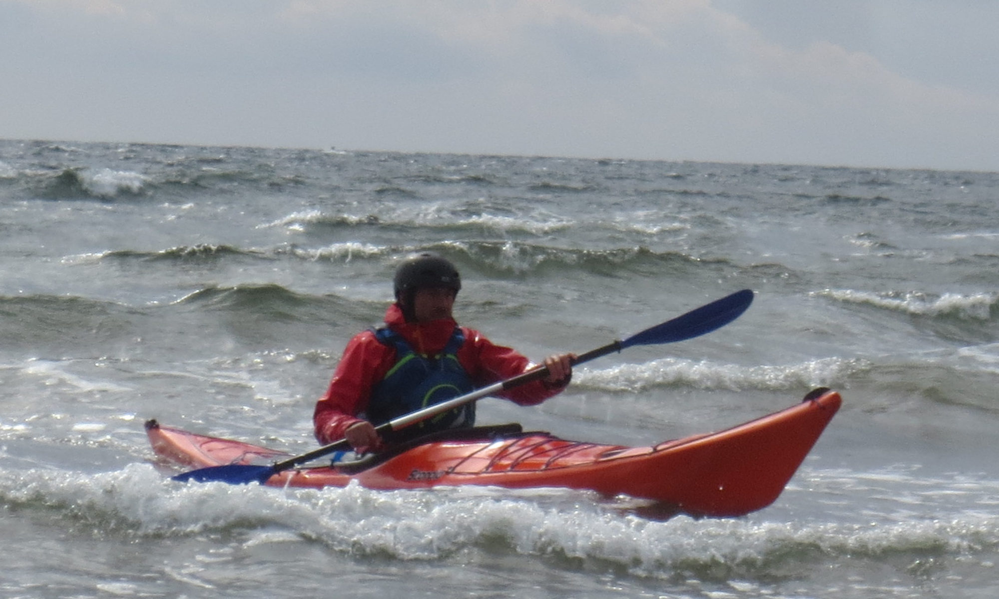
Staffa is undoubtedly a mecca for sea kayakers and for the outdoor community as a whole. IN additon to our own phots we have had photos from the sea kayaking colleagues we met on Ulva and, most recently, from an outdoor group visiting that took the ollowing photos of us at Fingal’s Cave.
Paddlers Hugh, Jeanette, Francis, Geoff, Vee and Adele
Route
Weather Saturday: Sunny but strong cold wind from North F4 rising to F5
Sunday: Mostly overcast with strong wind from north F3 rising to strong F4
Report We met at 5.45am and travelled to Oban having booked on the 08.15. The road was clear and scenery sensational as ever.
We luckily just managed to catch the “Isle of Mull” at 07.30. From Craignure we travelled NW to Salen then west along Loch na Keal to Clachandhu on the Kinloch road departing the beach at around 10.15. There is a lot of parking and we would advise this route in preference to the chaos that sometimes occurs at Ulva Ferry.
The paddle across was into a strong northerly wind which, despite a lovely sunny day, made it very cold. Although the cliffs along Ulva are superb, with long basalt terraces, it is not easy to land.
Ulva with Gometra is probably the worst example of “the clearances” in Scotland. In 1841 the population was 859. This was cleared by the owner, an F.W.Clark and by 1981 had shrunk to a mere 13. There has been a slight recovery to between 20 and 30, around 3% of the 1841 population. It is currently owned/managed by James Howard, the grandson of Edith Howard, Lady Congleton, who purchased it in 1945 for £10,000. It is now valued at over £3m.
The area is very popular with sea kayakers, although many do not venture out to Staffa and the Treshnish Isles. We met such a pair following the coast from Iona.
Meeting other paddlers in front of a basalt terrace
After some time we eventually found a beach and at around 11.30 stopped for lunch.
After our early lunch we paddled on towards a cluster of islets just east of the Gometra channel. En route were a pair of otters fishing and entertaining. Before rounding the headland we stopped for a break at what appeared to be a first class camp site. This was already partly occupied by a group of sea kayakers from north Manchester who had arrived on Friday but had not got any further because of the wind around the point. Despite persistent and growing wind, we had hoped that we might get as far as Lunga and had been confident we could get to a known camp site at the end of Gometra. However from observation of the channel it was clear that the wind was currently too strong for prolonged paddling so we decided to wait in anticipation of it falling. It did not and at 18.00 we set up camp for the night.
The site is indeed excellent and after our evening meal we sat down round a beach fire with our colleagues from England for an enjoyable evening of stories and whisky, the last of our party getting to bed at around 1am.
Early morning was bright and sunny with no wind but by our departure at 8.30 it was clouding over and beginning to blow. We rounded Little Colonsay headed out on the 8km crossing to Staffa.
Leaving Ulva
Staffa is a must do for sea kayakers with awesome massive basalt columns cut by three wonderful caves.
McKInnon’s CaveBoat Cave
Boat CaveGroup at mouth of Fingal’s CaveFingal’s Cave
Landing on Staffa is not easy. There is a small jetty for the tourist boats. Leaving boats here is not appreciated as there is very little room and it blocks tourists who have paid substantial sums for the trip to the island. There is a rough rocky beach to the north of the jetty where we landed for a well-earned lunch and a walk if desired.
At 12.15 we left Staffa for the return trip to Little Colonsay covering the 8km in about one and a half hours. Significant numbers of puffins were seen en route.
Little Colonsay is even less easy to land than Staffa. On the south-east corner at Port an Roin there is a stone jetty, which at the tide state was virtually impossible for a kayak. Just east there is a thin inlet and with considerable difficulty we managed to land paddlers and haul boats up on rocks.The house itself is large and appears to be a holiday house capable of sleeping up to a dozen. The island is currently owned by Michael Hare, 2nd Viscount Blakenham, but has not been permanently inhabited since the 1940s.[6] Hare’s daughter, Cressida Cowell, the author of children’s books including How to Train Your Dragon, spent childhood summers on the island and cites the Inner Hebrides as an inspiration for her books
From Little Colonsay we headed directly for InchKenneth with a following F4 wind. This type of paddling can sometimes be uncomfortably unstable but all paddlers managed well. Coffee was taken at the central beach.
InchKenneth is totally different geologically from the basalt rock blocks of the islands further out, with a series of lovely sand beaches on the south side. It is very fertile and was an important ecclesiastical centre attached to the Abbey on Iona. The ruined chapel and graveyard are worth a visit.
It was a relatively short paddle back to our starting point which we reached before 5pm, having covered some 30km (20 miles) that day with surprisingly little effort. We arrived back at Craignure at 18.30 for the 19.30 boat. Fish,Chips and Tera on board completed a throughly satisfying trip.
The training started in earnest this month. Hugh started off with an evening paddle for the Sea Kayak Expedition programme to the Sugar Boat on the 4th with Geoff, John R and Sheila. The following evening 18 Beginners and other members met at Luss. Robin and Tim took the least experienced along the shore and up the river, whilst Geoff headed off to Inchlonaig . On Wednesday 11th Hugh, on an evening with a strong F4/F5, took Jeanette and Francis (and Geoff) along to Rhu Spit to experience wind against tide in the narrows. A lumpy experience.
On Wednesday 12th 19 gathered at Lomond Shores. The strong wind, which had been a feature of the last two weeks, thankfully died. The youngest (Alex, Jamie & William) with Tim and Stewart T. concentrated on building up some strength close to the lagoon area. The other 14 (Allan, Ross, Stewart, Rosie, Bella, Adam, John, Sheila, Paul, Mathew, Jenny, Rowan, Kerry, Geoff) had a mix of paddling, stroke development and ball games. A lovely evening and a useful training session.
For reference the Training Programme:
HCC-Beginners Course
May
3rd Tues 7:30pm – Pool session
5th Thurs 6.30-9pm – Luss, River and Basic Skills (No Euan)
10th Tues 7:30pm – Pool session
12th Thurs 6.30-9pm – Lomond Shores, (No Euan)
17th Tues 7:30pm – Pool session
19th Thurs 6.30-9pm – Luss, island trip and seal launching
24th Tues 7:30pm – Pool session
26th Thurs 6.30-9pm – Kidston Park-Rosneath Caravan Park
Paddlers: Clyde; Hugh, Bill, Geoff, John and Sheila; Loch Long: Lee, Tim, Charlotte and Geoff
Weather: Wonderful on both days. Light breeze from SW on Thursday
Reports: Wednesday Evening was set up as a Training Paddle to identify which trips might be suitable. It was a wonderful night and flat calm. The group simply went to the sugar boat and returned just as the sun set.
At the stern of the sugar boatA bit of clapotis along the bottom (Bill and Geoff)Sheila and Geoff
On the following day another simple trip in glorious weather. We met at 10am at Finnart before crossing to the west shore. It was calm and sunny as we progressed north, expecting the promised northerly winds. Stopped for a break and sunbathe at the huge new hotel by Ardgarten. Crossing back to the east shore to Ardmay House we were conscious of a F2/F3 wind from the South West! Given Charlotte’s time constraints we headed back into the wind with two of our number turning a gentle recreational paddle into a high speed challenge. Charlotte in her Epic7 won.
As a result we arrived back at Finnart far too early and Lee and Geoff decided to carry on across to Mark Cottage for a brief inspection. After another break and sunbathe by both groups we returned and were away about 4pm
Report: Pete Baker initiated this paddle and the three of us joined him and two others (Susan and Alan) at the pier for the paddle.
Our Allan with Clydebank Alan and Colin looking to Craigendoran.
We headed for Rosneath Point with a discernible, if light, north easterly pushing us along and causing both a light swell and the less experienced some uncertainty. At the Point we were met by a flotilla of seals which must have numbered about 20 or so.
A short stop was made at the Point to ballast Allan and Colins boats to improve stability. It worked. We then proceeded to Gourock Outdoor Pool before going along the shore looking for a suitable lunch stop. We eventually found an excellent beach just past the ferry terminal but beware of the wash from the Gourock to Dunoon high speed catamaran which generates a big if shortlived wash. This, in turn, has a lot of fun with any boats just on the water’s edge.
The tea break at Green Island looking at Craigendoran
After a leisurely lunch we crossed back to the north shore and paddled along past Kilcreggan pier for a tea break at Green Island (just round the point). This is now recommended as a stopping point with extensive flat sandy areas resulting from on-shore works. At this point we split with our group heading straight for Craigendoran whilst Pete’s went on up to Rosneath to investiagte curren scrapping at McGruers. A very succesful day.
Weather: Started grey then cleared and became brilliant, with a F3 SE breeze. Night clear and very cold with cloudless blue sky in morning. Clouded after noon with strongish SW breeze.
Route:
Report; The glacial trench that forms Loch Etive starts in Glencoe reaching salt water at Glualachalain and then on for another 30km. It contains some of the most impressive and beautiful scenery in Scotland and we were lucky in seeing it at its very best. Double click on any picture for full screen version.
The parking and launch point is just at the mouth of the River Awe, which provides a quick getaway on to the loch.
Launch PointLeaving Taynuilt
As we paddled north the grey skies broke completely and a strong breeze from the south developed. The views up the loch to Ben Starav and further to Bidean, Buchaille Etive Mor and Buchaille Etive Beag were sensational.
Looking NorthAdeleHughGeoff
We paddled up the east shore, stopping for lunch at Glen Noe, before crossing the loch for the beach at Barrs. The breeze was, by now, strong enough to allow a little surfing.
Vee, lunchtimeLunchLooking south across loch to Ben CruachanSome shelter in the riverEvening at the Beach
Barrs Bothy lies about 500m up a steepish climb on a terrible path. It is a “private”, single roomed bothy now being maintained by the Borders Bothy association after some years in the care of Argyll Scouts, and is both well hidden and very difficult to get to. Water is problematic and has to be carried up from the river.
After landing we carried our gear up, fully intending to return to the kayaks and carry on up the loch. Such plans did not envisage coffee and cake in a sun-drenched, wind free location. Coupled with the thought of battling against the wind to get back if we went further up the loch, we stayed.
Barrs BothyRelaxing in the SunIn the Bothy; Kitchen AreaAround the Fire
As the afternoon progressed all clouds disappeared and the wind dropped. Thanks to excellent work on the saw and axe by Hugh, a splendid fire kept us warm with sub-zero temperatures outside. In the morning, after sunshine for a couple of hours, the boats in the shade were still covered with ice. Meals were cooked, beer, wine and whisky drunk, and the evening slipped away.
Sunset over the hills to the west
The morning was brilliant.
After clearing up we retraced our steps down the hill through the soft ground.
Leaving the bothy looking north to Ben Starav. Bothy roof can just be seenLooking south on path to beach
The return paddle was kayaking at its best; sensational scenery and placid water.
Leaving BarrsLooking east towards Glen KinglassHeading South
The Mountain Bothies Association maintain an “open” bothy a few kilometers south of Barrs. On investigation this appear to be an excellent 3 room alternative.
Cadderlies Bothy (MBA)
By now cloud had started to gather and a strong breeze from the South east (straight at us) was developing. As a result the next few km to Bonawe were quite challenging. We decided to go through the narrows before stopping for lunch. We had originally contemplated going on westward to Ardchattan but by now it was totally grey and getting cold with the strengthening wind so we decided to call it a day and paddled back the Taynuilt side to land on the sand just to the north of the stone pier. Thus ended a wonderful weekend,
Report: The trip wasoriginally intended primarily as a little bit of exercise for a couple of regulars with no planned route or target. In fact the trip proved memorable in a lot of positive ways with only one of the group having previously visited Newark Castle and for most it was a first visit to the sugar boat.
We set off around 10.15 and set a fast pace across to Ardmore. From there we headed across the Clyde towards the Ferguson shipyard at the east end of Port Glasgow (https://en.wikipedia.org/wiki/Ferguson_Shipbuilders). Here, the consequences of “not planning” were illustrated fully as at the deep water channel we had to battle against the peak tidal flow which runs at between 2 and 2.5knots. With boats only making a maximum of 4 knots , it was a tiring 20 minutes.
After a half hour break for food and drink it was back on the water heading for the sugar boat. The Clyde between Cardross and Port Glasgow is one huge complex of sandbanks at low tide. The direct route led straight through these but apparently there was a channel which we believed would be negotiable in kayaks.
Heading for the “gap” in the sandbanks
Sadly we were wrong and for around 200 yards we were walking in between 3 and 9 inches of water in the middle of the Clyde.
Walking on the Clyde
The sand was surprisingly firm and all negotiated them with ease, before settling down for the paddle to the sugar boat.
Nobody could be persuaded to climb up on to the boat so after the customary circuit we set off back to Craigendoran, arriving just after 1.30pm. An excellent, interesting and enjoyable paddle of around 17km.
Paddlers: Hugh, Bill, Adele, Ginette, Sheila, John and Geoff
Weather: Dry but grey. Suprisingly little wind (F5 forecast).
Route: Luss,Luss River, Inchtavvanach, Incconnachan, Luss
Report: Very much a training day with sections on paddling, using moving water and rescuing, it still provided opportunities for some excellent photos courtesy of Sheila
Looking across beach on Inchtavanach to Beinnn DubhLunchLooking East towards Conic HillStand Up Paddles (SUP) passing by
Double click on photos to view full screen. Especially recommended for two photos; “North beach, Inchmurrin” and “Inchmurrin, Creinch, Torrisnch and Clouds”
Paddlers: Geoff, Lee, Tim and John R.
Weather: Brilliant. Bright sun all day.
Route:
Report: South Loch Lomond is a familiar patch of water for training so this trip we aimed to do something different by looking and photographing the castles and mansions of the area. As will be obvious from the following, the incredible natural beauty of the Loch still completely dominated the trip.
Departure:Lomond ShoresCastle 1: Balloch Castle (behind trees)Heading NorthBoturich Castle. (From west shore as cannot be seen from east)Looking SW from base of Inchmurrin CastleAn advert for Lomo Dry Suits. Looking N from Inchmurrin CastleThe beach at the north end of InchmurrinCastle 4: InchgalbraithRhossdhu HouseLunch by the golf courseLooking east from Loch Lomond Golf CourseInchmoan and Conic HillInchmoan, Inchvannach and Ben LomondInchmurrin, Creinch,Torrinch and tele-tubby cloudsArden HouseLomond CastleAuchendrennan House (Formerly Loch Lomond Youth Hostel)Cameron House
Left about 10.30, leisurely paddle with prolonged coffee and lunch stops, 20km and back by 4. A wonderful day.
Route: River Teith; Callendar to exit point on left bank 800m past the Torrie Rapid
Report: After normal delays involving car transfers we finally got on the river at the Callendar Car Park at about 11.15.
We then paddled the canoes up to the junction of the Leny and the Teith for some introductory instruction on Ferry Gliding and to get used to canoes and particularly tandem canoeing. From there we headed down river through increasingly difficult water with various much appreciated stops for instruction and coaching.
The importance of using eddies became increasingly obvious. Afetr an excellent lunch we then headed further down through various Grade 1 rapids until we reached the crux; the Grade 2 Torrie Rapid. All decided to run the rapid and all did succesfully.
Stewart and AdeleGeoff and BooVeeMarkMoose(?)
We arrived at our exit point around 3.30pm. To get to the cars we had a short steep climb up from the river to the road and then a crossing of the A84 to the lay-by, probably the most dangerous activity of the day. The usual delays in changing, tying on and collecting cars resluted in a 5pm arrival in Helensburgh.
All in all an excellent day, with many thanks to Neil for arranging it and Grant and Moose for coaching. Our thanks to Grant for illustrating that not only novices go swimming. Trip much appreciated. Still have a way to go though, albeit not so far, to convince me to use a canoe rather than a kayak.