Ardnumurchan 21st-23rd August 2013

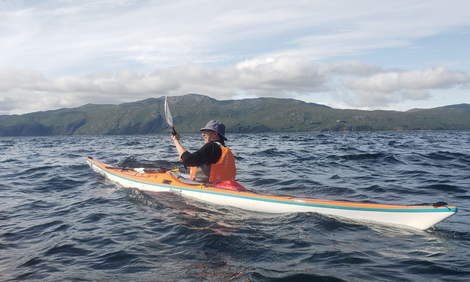
Paddlers: M.M., Hugh and Geoff Weather: Very Mixed; Glorious Sunshine, Torrential Rain, Calm and Windy. Route: ard8_13Map Description: The remote Ardnumurchan peninsular is the most westerly place on the British mainland and rounding the  headland is something of a target for all sea kayakers. Like all sea kayaking the feasibility is totally wind dependent and our conditions were excellent with a light southerly breeze and sunshine. We started towards the mouth of Loch Sunart at an easy launch point after a second car had been moved up to the finishing point on the other side of the peninsular. One of the difficulties is finding both camp sites and launch points and, in retrospect, a longer 4 day trip from Salen round to Ardtoe and Loch Moidart might have been better. The weather was overcast and the cliff scenery excellent. Two Sea Eagles circled overhead.

ard8_13 002ard8_13 001ard8_13 003

Mingary Castle, which is found just before the village of Kilchoan, is the 13th century stronghold of the Clam McIain. It is owned by a Trust and is currently being restored with funds from the local landowner (Ardnumurchan Estates) and the National Lottery. When we arrived they had nearly completed scaffolding with scaffold poles and fittings made of stainless steel. When finished it will be a complete castle for let, presumably for historic weddings etc.  Web sites (e.g. http://www.mingarycastletrust.co.uk/mingarycastletrust/) give lots more information.

ard8_13 004

We found a good campsite a km on with flat ground, a good supply of wood and no houses in the vicinity. During the evening the cloud lifted and although sea mist and fog was threatened none came over the camp site.

The Campsite looking towards Coll
Moon and Fire
Moon and Fire


ard8_13 015
Morning Mist from campsite

The mist that swirled around early on Thursday soon cleared and the sun soon illuminated the surrounds. A dominant feature of the trip was the high spring tide which generated very high highs and very low lows with a range of over 12 feet (4m). We originally intended to leave late to catch the north flowing tide but instead left early to ensure that we could float the boats from the beach, rather than carry them over slippy sharp rocks for 200m,  In fact the south flowing  tide had minimal impact relative to the southerly breeze that pushed us along a spectacular coastline towards the headland.

The cliffs were characterised by bands of rock, sometimes at rigth angles to each other
The cliffs were characterised by bands of rock, sometimes at right angles to each other

In  a couple of hours we reached the headland and lighthouse.

ard8_13 019


Ardnamurchan Aug 13 010

The views were spectacular. Looking north  Muck, Rhum and Eigg  were in  the foreground with the Cuillins of Skye and Knoydart as the background. To the far west the Outer Hebrides were just visible and in the south west stood Coll. On days like this, there is nowhere better scenically.

Ardnamurchan Aug 13 012
Boats marooned beneath lighthouse as tide dropped

After a long lunch break and exploration of the lighthouse and facilities we retrieved the boats from where they had been marooned by the rapidly dropping tide and paddled over to investigate Sanna Bay and identify potential camp sites.

Sanna Bay
Sanna Bay

By this time the tide was very low and any camp site would have required a carry of several hundred metres, so we went on to assess another potential site around the headland. In this case the sand beach was protected by a minefield of sharp rocks; OK at half tide and above but impossible at the current state. On again to another sand beach but on this occasion the rocks lay between the sand and the potential site. However there were some deep caves, known as the Glendrian Caves, to explore.


In the Glendrian Caves

After this interlude the hunt for a site was really on. On the map, about 1km on, a path was shown descending the cliffs and this was taken as a possible site.  This proved correct although flat space was limited and firewood was non existent. However a fire was made using dried kelp and an enjoyable evening was had by all.

ard8_13 033

ard8_13 034
Late evening

During the night the wind got up and by morning was gusting at around 20mph. As we finished breaking camp the rain started and the short distance we had to travel became a blessing. In fact the rain was intermittent and the wind gusty and, because of the high cliffs, came from all different directions and none. The cliffs were broken and a number of caves both shallow and deep apparent. It is excellent sea kayaking terrain.

ard8_13 035We arrived at Fascadale, our exit point, just after 10am in the pouring rain. Enthusiasm for continuing was limited and soon we set off back to the other car and then homewards.

Originally there were another 4 club members interested in the trip but for a variety of reasons they eventually could not make it. On the basis of our experience it is thoroughly recommended. It is a stunning and satisfying paddle worthy of the heather that marks a successful trip round Ardnurmurchan Point. Provided care is taken and the weather is OK it is suitable for paddlers of all abilities.

Caribbean Princess August 8th 2013

Paddlers: Geoff, Davod, Ross and Douglas

This was a hastily arranged afternoon trip in quiet weather to look at one of the giant liners now using Greenock. Depart about 2pm, arrive about 3, return via Fishery Protection Vessel Marina about 4.30pm. A good trip with some spectacular photos.

clyde august 2013 001clyde august 2013 007clyde august 2013 008

Lismore 6/7th July 2013

Paddlers: David, Innes, Sue, Alan, Jamie, Douglas, Geoff

Objective: A circumnavigation of Lismore

lismore map


Saturday: The day started well with all paddlers at the Ganavan Beach, 2 miles north of Oban, before 10am. This is a excellent start point with a large shallow sandy beach and excellent parking (£2 per day).The weather was breezy mostly overcast but with occasional breaks. We had opted for Ganavan to make best use of tide and wind and so it proved. There was a big swell driven by a Force4 and it made for interesting paddling.

Departure at Ganavan

lis13 004

Our first stop was for the Lismore Broch. Brochs are large circular towers with a hollow wall. They are found only in Scotland and are thought to be around 2000 years old. The Lismore Broch is well worth a visit if only for the stunning views.

Douglas takes photos from the Broch

We pushed on northwards with the weather becoming more and more threatening. Around the point we decided to camp at the site just at the point. However when we arrived we found another group of 14 erecting tents. After some discussion we decided to push on and try and find an alternative. In retrospect it was a blessing for the next bay not only contained flat (tish) ground but a wood supply (albeit difficult to access) in the surrounding woodlands. As the evening got increasingly wet, the fire proved the highlight.

Around the fire in the rain
The campsite
The campsite

Sunday: After a very wet evening the next morning dawned dry and bright. The view from the site was excellent with Glensanda prominent on the Morvern shore.  As agreed we made an early start (8.10) to catch the south flowing tide aiming to reach the southernmost point at 12.30; slack water.

On the way from the site

The next stop was the spectacular Coefin Castle (ruins).

Coefin Castle
Coefin Castle

lis13 016

Lismore trip July 13 154

The group in the castle

The weather was constantly improving as we headed south. The headwind was dropping to negligible, the sun came out and dolphins/porpoise came to play. Seals looked on expectantly and an otter stopped and stared.  The cliffs revealed caves and gashes; this was what one hoped for.

Lismore trip July 13 168

After a break for inspection of yet another castle (Adachurn) and lunch we headed on for the point. As we reached the point at peak low water, there were two linked questions; 1)  can we get through behind the lighthouse island? 2) Do we want to if we can?. In the end we decided that round the light was more exciting and the gap probably does exist even at low tide.

David at Adachurn Castle

The final decision was whether to paddle the 9k directly back to Ganavan or travel up the coast and jump across the islands. The direct route was chosen and some 1.5 hours after setting off we reached the beach.  Another excellent trip.


Loch Long Thursday 2nd July

Paddlers: Euan, Jamie, Geoff, Jim, Mark

Weather: Grey, cool but calm

Report: We met at the car park just north of Cove. The initial crossing was to the pier at Blairmore. It is sad that there is no service to the pier after spending quite considerable sums to rejuvenate it. With the closure of the hotels at Carrick Castle and Ardentinny and no water service the  future looks rather bleak for this part of Argyll and Bute.

Blairmore Pier
Blairmore Pier

We then headed north, passing the “new” wreck, landing just past the caravan park at Ardentinny for a quick break.

Time for a break
Time for a break

The uneventful last leg was  straight back across the loch to complete a 10 mile circuit.


River Leven and Canoe Camp

River Leven: Thursday 20th.

Paddlers (13) : Euan, Alex, Cory, Ross,  Adam, Michael, Oliver, Nat, Robin, Adele, Gregor, Grant, Geoff

Report: A good turnout on a dullish evening did the annual trip down the Leven. This year the flow was quite limited and in the lower reaches was completely negated by the incoming tide. As a consequence we took almost 2hr 30 mins. However there was enough water for an enjoyable experience and the rain held off.

Loch Lomond Saturday 22nd/Sunday 23rd

Paddlers (14): Cory, Ross,  Adam, Michael, Nat, Robin, Gregor, Grant, Stewart, Hannah , Eleanor, Stuart, Rachel, Geoff

The Main Group
The Main Group

Report: The weather forecast was not great with heavy rain and very strong winds on the Sunday. More than one person was expecting cancellation but, because of the relatively sheltered nature of the planned trip the decision was made to continue. Consequently the group gathered at 2pm and after the usual problems of beginners fitting their gear into boats, we set off for Inchconnachan for a wallaby hunt.

Fleet on the move
Fleet on the move

At the normal site the group split. Stewart, Geoff and Eleanor were lucky enough to spot one in the dense undergrowth, purely because it moved as we approached. There is one in the next photo.

Spot the Wallaby
Spot the Wallaby!

Despite the cloud cover it was dry and the views, as usual were fantastic

Down the loch from the Inchconnachan beach
Stuart and Rachel
Stuart and Rachel

The weather stayed dry as we rounded InchConnachan and headed for our camp site on Inchvannach.

IMG_2534


On arrival tents were pitched, barbeques lit and a fire built and lit.  Nat and Robin erected their Gazebo which proved very popular when the rain arrived. Stewart and Geoff, meanwhile, erected a conical shelter over the fire.

After food Geoff, Stewart and Eleanor had a short trip to pick up Hannah. During this trip it began to rain very heavily and continued off and on throughout the evening and night. Despite the wet and because it was becoming horribly midgy,  most went out for an evening paddle getting back just as the light started to fail at 10.30. A late swim was undertaken by some. All had retreated to their tents by midnight.

The Sunday morning was bright and quite dry but blustery. We cooked breakfast and were off soon after 10am

IMG_2570


Departure from site
Departure from site

The paddle up through the narrows was fine but we exited straight into a north westerly wind blowing around force 4, occasionally gusting much higher. It was an important lesson that kayaking can be a challenge and that the Loch can be a very dangerous and unforgiving place. However all coped well (if slowly).

Because the wind was expected to increase during the day we had arranged to finish at 11am and duly got to Ardlochlay at 11.10. An excellent weekend.


Taransay and Loch Roag, June 2013

Paddlers: Geoff, Hugh and Jamie

Day1/2. Taransay

taransay2


We left Ard Asaig, a couple of miles west of Tarbet, at about 11.30 having caught the morning boat from Uig and over-nighted in a camp site by the ferry port at Uig. The weather was as forecast, cold and windy with the cloud almost down to the loch. The initial paddle to the lunch break on Isay was quite tough but after lunch we hit the main swell and force 5 winds. Just as we were contemplating retreat we spotted a rock beach and landed, hoping for the weather to ease. It did not and a tent was pitched for shelter. A shelter wall, firewood and a fire followed and by the time the wind eased (7pm) we had given up any idea of further progress.

the hills of Harris close to our departure point
The hills of Harris close to our departure point
The rock beach
The rock beach
Camp Site
Camp Site

Sunday morning was overcast and breezy but the crossing to Taransay appeared on. After a difficult launch as we made our way out between a wave break and the shore a large otter appeared, stared and disappeared.

Taransay was featured in the BBC series Castaway in which 30 people were landed on a deserted island for a year. The identified objective was to observe the development of a community.  The island is large, relatively fertile and has some beautiful sand beaches. Sheep are grazed over the whole island and there are a couple of summer holiday houses. All round it appears to be a very pleasant place.

Heading for Taransay


Taransay
Taransay
Taransay Beach
Taransay Beach

Objective achieved we crossed to another lovely surf beach for lunch (nice bouncy entry and exit) and then back via Isay to the car for part 2 of the trip.

Day 3/4/5 Loch Roag 

Wild camping from the car was surprisingly difficult, but, after an hour driving around and a trip to Callanish Stone Circle  we found a lovely picnic site above a wonderful surf beach just north of Carloway.

Callanish
Callanish

 OLYMPUS DIGITAL CAMERA

Evening at Dail Mor picnic site


The camp site
The camp site


Our launch site was back towards Callanish. From here we headed out for a circuit of Great Bernera.

roag2


Noticeable features of this area were the population of Great Bernera (apparently “cleared”  from the mainland in the 1870s), the extensive fish and mussel farms and the stunning sand beaches. Possibly the best of them was our lunch stop on Little Bernera.

Heading for Little Bernera Beach
025
The Beach


Bernera Beach
Bernera Beach

After lunch we rounded the headland and into the sizeable Atlantic Swell. From there we headed to the channel between Great and Little Bernera before landing on yet another golden beach. The main interest at this beach was an Iron Age village which had lain undiscovered under a layer of sand until recently. A feature is a reconstructed house which, unfortunately was closed.

Iron Age House
Iron Age House

 After some debate a rock beach on the island of Floddaigh suggested a possible place for the night. As we left we were drawn towards a basking shrk that had apparently been in the area all afternoon. We were lucky enough to get a close inspection of the fish whose length was around 20ft.

Basking Shark
Basking Shark

Floddaigh was the nesting place for thousands of sea birds and care had to be taken not to tread on nests and newly born chicks. There was however a mass of wood, flat ground and a stunning sunset.

Fire and Cooking on Floddaigh
045
Sunset

042


The clear sky of the previous evening augured well for Tuesday. The first objective was the famous (among  keen sea kayakers) Pabbaigh Mor. As we approached a dolphin/porpoise decided to play in front of us.

The island proved to live up to its reputation. The first feature is a large sea cave but this was of minor interest compared to the stunning natural arch.

052 055


The photos were taken at a quiet period. In fact the big swell at times generated a very exciting experience! We next sought out the entrance of the lagoon but after entering what looked like the entrance we decided the tide was probably too low so we opted for the south entrance. En route was a “gap” , confused and treacherous in the big swell. After a long period of contemplation sense won over challenge and we went round outside and then into the lagoon.

After the tumult outside the lagoon was amazing, with three lovely sand beaches and completely quiet water. It  also had a wide north entrance that we had missed.

A beach in the lagoon between Pabbaigh Mor and Beag


We then decided to investigate the sand beach just 3km away at Camas Cliobh. This beach was totally open to the Atlantic so we expected some surf, but it appeared from the sea to be relatively small and canoeable. This was not the case. All of us were turned and Geoff ended up on the sand upside down.

057-001
Hugh rides the surf (detail)

057


Jamie views the surf

We then spent the next 30 minutes trying to work out how best to get out. The shape, frequency and power of the surf and the resulting shape of the beach made exit problematic. Just as the kayak floated  it was hit by a wave, turned, filled with water and beached. What was required was a young flexible paddler who could get into the kayak after the initial wave break. Our hero was Jamie who towed the old men past the first break to allow them to escape and then managed to get his boat clear” and use the keyhole cockpit to get in. Once past the surf line his kayak was  pumped out and we were all clear.

After the excitement we paddled on the the township of Bhaltos which offered a telephone box and campsite in the way of services and two more glorious sand beaches.

Hugh and Jamie on boat at Bhaltos


The ideal campsite has a sand beach, flat turf immediately adjacent, good views and a wood supply. Unfortunately the first and last are very rare and we put the fire as a higher priority than soft entry and exit. So we choose the island of Fuaigh Beag for our final camp., a very satisfactory choice.

Campsite at Fuaigh
Campsite at Fuaigh
065
View from Fuaigh Mor


The final morning was a quick paddle across the east side of Great Bernera under the bridge. and we reached the launch site at around 11pm. Sadly we found a side window had been smashed, possibly by a stone from the road. We suspect the police do not really believe this either but, in any case, they were extremely helpful and found us an autoglass agent who immediately fitted a temporary window for th long journey home. If it was deliberate the locals in Stornoway certainly tried to make up for the sins of their brethren and we safely caught the 4pm ferry from Tarbet. It was a beautiful crossing.

Tarbet
Tarbet
069
The Paddlers


With wonderful weather the route back must be the most glorious drive in the UK. crossing/passing  five wonderful mountain ranges; The Harris Hills, The Cuillins,  Glen Shiel, Ben Nevis and the Grey Corries and finally Glencoe. IT was a fitting end to an excellent trip.


Seil, Cuan, Belnahua and Easdale 18th/19th May

Paddlers: Jamie, David, Innes and Geoff

Weather: Very, very windy on Saturday. Sea Fog on Sunday.

Innes, Jamie, Geoff and David at Clachan Bridge ("Over the Atlantic")
Innes, Jamie, Geoff and David at Clachan Bridge (“Over the Atlantic”)
seil map
The route


DSC03239
Ready for Departure

Report: The forecast was perfect; Northerly force 4 to 5 to blow us down on the south flowing tide to the Garvellachs followed by a strong to gale force wind with rain when we were safely tucked up in bed. On Sunday a calm sea with a strong north flowing tide to take us back to Easdale. However nobody told Boreas and when we arrived at Easdale it was blowing 6 to 7 possibly 8.  A strategic withdrawal was the only option and the new plan involved a sheltered trip down Seil Sound and then, with the wind forecast to strengthen (!), a paddle along Loch Melfort looking for the perfect sheltered camp site. And that is what we did

The Campsite on Loch Melfort


Looking west from the campsite


A superb camp fire
A superb camp fire


Depart Day 2
Depart Day 2

The site was almost perfect being flat, well sheltered and with an excellent wood supply. An excellent evening was had until the rain started at about 11.

Before turning in we had hatched a cunning plan to start early to catch the tide at Cuan Sound and at Belnahua and so at 5am we were up and by 6.15, having breakfasted we were afloat. The wind had completely disappeared and was replaced by a thick wet sea fog. The calm and quiet was ethereal.

Approaching Cuan
Approaching Cuan


The passage behind Torsa was deep and flowing and the tide shifted us on at 3 knots plus our own speed through Cuan Sound and out into the Sound of Luing. By keeping close into shore we were able to easily paddle in the eddy caused by the Cuan outfall down to Cullipool.

Through Cuan Sound
Through Cuan Sound


Breakfast at Cullipool

Visibility varied from poor to none and we were worried about missing Belnahua as we got into the strong tides, so we decided to head south behind the skerries and then follow the islands out NE. As we got towards Fladda we were all suprised at the size of the flow and the multiple directions as it past Fladda

Tidal flows near Fladda

Belnahua is one of the two Slate Islands. It was quarried until the First World War when demand and cost associated with continuous pumping to keep the pits dry from rampaging storms led to its evacuation. The legacy of ruined buildings, flooded quarries and slate waste combined with the mist provided an eery spectacle

Belnahua
Belnahua


Getting the Bearing
Getting the Bearing

From Belnahua we headed by compass course set to get close to land as quickly as possible but avoiding the tumble of water from Cuan Sound. As soon as we got visibility we turned and headed for Easdale, the second of the Slate Islands. Unlike Belnahua, Easdale Island has a thriving economy with a pub/restaurant, museum and village hall.  On Easdale we met Andy Warrender who last year circumnavigated Tasmania and this year is attempting the crossing to Norway. He had offered us a lift to Clachan but advised paddling it round the west and north sides; advice that was taken.

As it turned out this was some of the best kayaking of the weekend with a substantial swell and superb cliff scenery with arches, caves and little inlets.

Jamie admires the cliff scenery

The time from Easdale back to Clachan was expected to be 1.5 hrs but we managed it in 70 minutes without any hurry.

By 4.00 we were packed up and in the pub for a well deserved drink after a super weekend.

Distances: Saturday 12km.  Sunday 31km

Loch Eck, April2013

Weather: Rain (Light, Medium, Heavy and Very Heavy)

Paddlers: Innes and Geoff

Route: Right Round the Loch from Dornoch Point.

Loch Eck, Long and Thin


Description: The weather says it all! Highlight was the pub with a lovely open fire to warm chilled hands and the whisky to keep us from going straight home. Seriously Loch Eck is a lovely paddle particularly for open boats with steep and high hills and lovely scenery. But when even ducks are hiding from the rain……


001
Innes in the Rain

Loch Morar, March 2nd/3rd 2013

Paddlers:

morar 019


Route:

loch morar


Weather:

Overcast with occasional breaks in the cloud for weak sunshine. Cool to Cold. Calm or very light wind from NW. Overnight (from about 6pm to 10am ) there was a wet cloudy mist  that made a dark night even blacker.

Report:

A clear drive from Helensburgh saw us at Morar in about 3 hours. Easy parking just up side road from Morar and an easy beach launch.

The scenery was superb with wooded islands at the west end and huge steep fiord like mountains at the East.

002
The Beach at Swordland
morar 018
The Path
The top of the path to Tarbet; looking to Loch Nevis


At Swordland we investigated the popular portage across to Loch Nevis. The surface is OK for large wheeled carriers but it is very steep. Not to be taken lightly.

From there we ventured on to the far end of the loch and the MBA bothy which, for some unknown reason, is named Oban.

morar 002
End of the Loch

013 (2)

010 (2)

The Oban Bothy
The Oban Bothy


As bothies go this was in the excellent category, dry with a good fire and a wood store. For the next hour or so the woodstore was filled and then the fire lit against the cold and damp now enveloping the bothy.

008

There then followed a good meal, a few drams and some stories. It is worth noting the remoteness of the bothy. The nearest habitation is Tarbet with a population of 4 and no road to anywhere. The nearest road was our starting point 12 miles away without a path. Indeed there were no established through paths in any direction.  We estimate that we were the only people for around 200 square miles.

At 10 pm it was off to bed.

The morning broke misty and wet but gradually dried and brightened up. By the time we left, just after 10am conditions were excellent with a flat calm instead of the expected breeze.

morar 011

morar 015


morar 017


morar 008


A gentle paddle brought us to some lovely sand beaches at Camas Luinge. Indeed there were good beaches and camping spots right along the loch. After a coffee break  we continued on to  Lettermorar. The croft here seems to have been deserted about 20 years ago. Sadly it appears that the whole loch community including Kinlochmorar and Swordland has gradually disappeared over the last 50 years leaving only the Bothy and a couple of summer cottages.

014 (2)

From here we paddled on to the islands where we stopped for lunch.

morar 020

017


A final paddle back to our launch point saw us at the cars by 03.30pm, away by 4pm and home at 7pm (unless you stopped for the excellent fish and chips at the Real Food Cafe at Tyndrum).

Total miles covered in the weekend was 24. Overall this proved to be a perfect winter trip up an unexpectedly beautiful loch. Recommended.

Club Programme: Early Winter 2012/3

Helensburgh Canoe Club

Programme: Early Winter 2012/3


December

Thurs 6th:  Midweek Paddle. Meet Cove 10am. Contact Geoff (674966) or email for further information.

Sat: 8th : Lower Orchy. Grade 2 river. Contact Grant if interested.

Sunday 9th: Beginners Sea Paddle. Meet RNYC 10am.

Wed 12th: Xmas Social. Meet Commodore 7pm for meal or join group at 8pm plus for a couple of drinks.


January

Tues  8th: First Aid for kayakers. Pool at 7pm.  Instruction/Discussion on what can happen and how to deal with it. Covers topics like Hypothermia, Asthmatic Shock, Hyperventilation, Heart Attacks, Breaks and Dislocations. Practical sessions in pool on dealing on water with unconscious casualties, exhaustion, broken or dislocated arms.

Sat 12th: White Water Safety and Rescue Course. Location tbc

Tues 15th: Adult Basic Skills (Start of 10 week course). Pool


February

W/E 2nd/3rd: Sea Kayak Bothy Weekend. Grade B plus. Location tbc